
Places near here
Photo credits
- National Inventory of Architectural Heritage
- Kenneth Allen, Geograph · Creative Commons Attribution-ShareAlike 2.0
- Richard Webb, Wikimedia Commons
- Kmcnamee, Wikimedia Commons · CC BY-SA 4.0
- Kenneth Allen, Wikimedia Commons · CC BY-SA 2.0
- Andreas F. Borchert, Wikimedia Commons · CC BY-SA 4.0
- Wanfried-Dublin, Wikimedia Commons · CC BY-SA 4.0
- danny kearney, Wikimedia Commons · CC BY-SA 2.0
- Kenneth Allen, Geograph · CC BY-SA 2.0
- Greg Clarke, Wikimedia Commons · CC BY 2.0
- Golfing in Ireland; photographer not stated, Source publisher
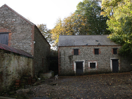 outbuilding294 yd
Explorer Tom Outbuilding in Three Trees has cast-iron mechanical cog wheels staring out from its south wall like a surprised beetle.…
 Greenbank Presbyterian ChurchChurch/chapel · 1413 yd
Explorer Tom Greenbank Presbyterian Church dates to 1862, with stained glass set into cast-iron windowwork. I thought the old stone…
 Cruckahenny TrailOfficial walking route · 1.2 mi
Explorer Tom Cruckahenny Trail takes you from Quigley's Point into the hills above Lough Foyle, and Donegal has arranged the climb…
 Muff GAA Grounds, Ture, Naomh Pádraig GAA, MuffGAA ground · 1.3 mi
 Quigley's PointHeadland · 1.4 mi
Explorer Tom Quigley's Point is where eastern Inishowen leans towards Lough Foyle and Donegal shows it can be quietly fascinating as…
 Eskaheen GraveyardGraveyard · 3.0 mi
Explorer Tom Eskaheen Graveyard lies on high ground looking over Lough Foyle. The earlier survey recorded part of the old church's…
 Eskaheen Portal TombPortal tomb · 3.4 mi
Explorer Tom Eskaheen Portal Tomb carries an enormous five-metre roofstone above its chamber. The slab slipped north, breaking one…
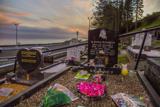 Drung GraveyardBurial ground · 3.6 mi
Explorer Tom Drung Graveyard sits on a plateau above Lough Foyle, hiding the ghost of an old ringfort. The earthworks are mostly…
 Squealin' PigPub · 3.6 mi
Explorer Tom Squealin' Pig is hogging the main road so badly the pigs are squealing at the traffic. The next village claims they…
 FinnegansPub · 3.7 mi
Explorer Tom Finnegans sits right next to Squealin' Pig on the main road, sharing the spotlight like stubborn toddlers. Pick one and…
 Muff ForestWoodland walk · 3.7 mi
Explorer Tom Lisnagra Woods near Muff is part of a walk with a name that sounds like the opening of a Donegal legend: Grania's Gap.…
 Foyle Golf ClubGolf course · 5.6 mi
More archaeology and monuments in County Donegal · All of County Donegal

What do you know about this place?Tap to add a comment or ask a question