What is recorded here
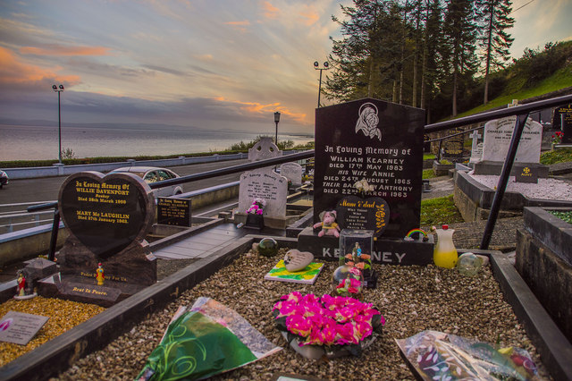
Marked 'Fort' on the 1st and 2nd editions of the OS 6-inch maps. The monument has been totally obliterated by use as a graveyard, and only the curving outline to the N, E and S survives to suggest the presence of a ringfort (DG031-005-). It is situated on a plateau, overlooking Lough Foyle, with a steep rise behind. The above description was derived from the 'Archaeological Survey of County Donegal. A description of the field antiquities of the County from the Mesolithic Period to the 17th century.' Compiled by: Brian Lacey with Eamon Cody, Claire Cotter, Judy Cuppage, Noel Dunne, Vincent Hurley, Celie O'Rahilly, Paul Walsh and Seán Ó Nualláin (Lifford: Donegal County Council, 1983).
From the National Monuments Service (Archaeological Survey of Ireland) record DG031-005001
The monument record does not grant public access. Check the route and ask the landowner before entering private land.
- What survives
- Recorded monument
Places near here
Photo credits
- Humphrey Bolton, Geograph · Creative Commons Attribution-ShareAlike 2.0
- National Inventory of Architectural Heritage
- Kenneth Allen, Wikimedia Commons · CC BY-SA 2.0
- Corinna Schleiffer, Wikimedia Commons · CC BY-SA 2.0
- Oliver Dixon, Wikimedia Commons · CC BY-SA 2.0
- Attila Terbócs, Wikimedia Commons · CC BY-SA 3.0
- Andreas F. Borchert, Wikimedia Commons · CC BY-SA 4.0
- DAYVEHUSE, Wikimedia Commons · CC BY-SA 4.0
- Greg Clarke, Wikimedia Commons · CC BY 2.0
- Kenneth Allen, Geograph · CC BY-SA 2.0
- MoorsoP, Wikimedia Commons · CC BY-SA 4.0
 Church of St. ColumbaChurch/chapel · 45 yd
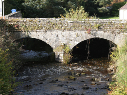 Drung BridgeBridge · 93 yd
 Quigley's PointHeadland · 2.2 mi
 CroaghmoreMountain / peak · 2.6 mi
 CrockavishaneMountain / peak · 3.9 mi
 Old CrossCross, High cross · 4.6 mi
 Cooley CrossMemorial · 4.6 mi
 Cooly Cat's Eyes Cross SlabCross-slab · 4.6 mi
 Cooly GraveyardGraveyard · 4.6 mi
 Muff ForestWoodland walk · 7.3 mi
 Inishowen Maritime Museum and PlanetariumMuseum · 7.6 mi
 GreencastleCastle · 8.1 mi
More archaeology and monuments in County Donegal · All of County Donegal
What do you know about this place?