What is recorded here
The 'Graveyard' (DG030-014002-) marked on the OS 6-inch maps consists of a subcircular area enclosed by the remains of an earthen bank. There is a holy well dedicated to St. Patrick c. 100m to the W. The site is located in cultivated land sloping E to Lough Foyle. Described by Ó Muirgheasa in 1936 as 'Near Three Trees, about a mile from Quigley's Point, is Tobar Patrick, with an ancient graveyard about 100 yards from it. This well is still visited at all seasons of the year by pilgrims' (Ó Muirgheasa 1936, 159). (Ó Muirgheasa No. 99)
The above description was derived from the 'Archaeological Survey of County Donegal. A description of the field antiquities of the County from the Mesolithic Period to the 17th century.' Compiled by: Brian Lacey with Eamon Cody, Claire Cotter, Judy Cuppage, Noel Dunne, Vincent Hurley, Celie O'Rahilly, Paul Walsh and Seán Ó Nualláin (Lifford: Donegal County Council, 1983).
The 'Graveyard' (DG030-014002-) marked on the OS 6-inch maps consists of a subcircular area enclosed by the remains of an earthen bank. There is a holy well dedicated to St. Patrick c. 100m to the W. The site is located in cultivated land sloping E to Lough Foyle. Described by Ó Muirgheasa in 1936 as 'Near Three Trees, about a mile from Quigley's Point, is Tobar Patrick, with an ancient graveyard about 100 yards…
From the National Monuments Service (Archaeological Survey of Ireland) record DG030-015
The monument record does not grant public access. Check the route and ask the landowner before entering private land.
- What survives
- Recorded monument
Places near here
Photo credits
- National Inventory of Architectural Heritage
- Kenneth Allen, Geograph · Creative Commons Attribution-ShareAlike 2.0
- Kenneth Allen, Wikimedia Commons · CC BY-SA 2.0
- Andreas F. Borchert, Wikimedia Commons · CC BY-SA 4.0
- Wanfried-Dublin, Wikimedia Commons · CC BY-SA 4.0
- Greg Clarke, Wikimedia Commons · CC BY 2.0
- danny kearney, Wikimedia Commons · CC BY-SA 2.0
- Alistair Cunningham, Wikimedia Commons · CC BY 3.0
- stuart r hines, Geograph · CC BY-SA 2.0
- Richard Webb, Wikimedia Commons · CC BY-SA 2.0
- David Dixon, Geograph · CC BY-SA 2.0
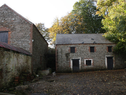 outbuilding388 yd
 Greenbank Presbyterian ChurchChurch/chapel · 1540 yd
 Quigley's PointHeadland · 1.5 mi
 Eskaheen GraveyardGraveyard · 2.9 mi
.jpg/250px-Eskaheen_(2).jpg "Photo: Wanfried-Dublin, Wikimedia Commons · CC BY-SA 4.0") Eskaheen Portal TombPortal tomb · 3.3 mi
Eskaheen Portal TombPortal tomb · 3.3 mi Muff ForestWoodland walk · 3.6 mi
 Drung GraveyardBurial ground · 3.7 mi
 Scalp MountainMountain / peak · 5.9 mi
 Castle & Earthwork Enclosure: Doherty Tower or Castle Aileach in Elagh MoreCastle & Earthwork Enclosure: Doherty Tower or Castle Aileach · 7.1 mi
 Slieve MainMountain / peak · 7.3 mi
 Millennium MilepostVisitor information · 8.7 mi
 Tower MuseumMuseum · 8.8 mi
More archaeology and monuments in County Donegal · All of County Donegal
What do you know about this place?