What is recorded here
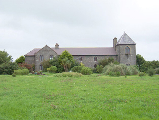
Detached multiple-bay two-storey former coastguard station, built c. 1875, now in use as private dwelling. Oblong main block facing east, square tower at north end, two-bay projection on east side of main block at south end. Hipped and pitched slate roofs, clay ridge and hip tiles, profiled aluminium gutters on painted timber fascias. Pyramidal slate roof to tower, lead capped wood-cored hip rolls, weather vane, cast-iron rainwater goods. Rubble limestone walling, tooled ashlar quoins, tooled ashlar strings, chamfered plinth. Pointed-arch window openings, smooth render or ashlar surrounds, stone sills, triangular stone sills to tower carried on stepped corbels, painted timber casement windows c. 2000. Pointed-arch door openings, hardwood sheeted doors. Situated at the end of road, painted entrance pillars to south with ball and bird finials, modern metal scroll worked gates c. 1970, winding avenue to house, lined with dry stone walls, mature planting on approach to house, stone boat house to east boundary, double garage to south-west of house c. 1995.
This interesting example of an early coastguard building is now in use as a private holiday home. It is imposing in it prominent location overlooking the bay.
From the Buildings of Ireland (National Inventory of Architectural Heritage) record 32401308
This does not grant access. Most recorded buildings are privately owned; view them only from public ground unless the owner allows entry.
Places near here
Enclosure in SkibbolecorraghEnclosure · 550 yd Derk HouseOfficially recorded historic building · 666 ydEnclosure in CarrowbrickeenEnclosure · 796 ydDerkmore PointHeadland · 896 ydBawnmoyleRuins · 1137 ydBawn in CarrowbrickeenBawn · 1148 ydCastleCastle, ringwork · 1.4 miPortavaud PointHeadland · 1.5 miStrandhill BeachBeach / strand · 1.7 miCulleenamoreBeach / strand · 1.8 miKillaspugbrone GraveyardRuins · 2.4 miGraveyard in KillaspugbroneGraveyard · 2.4 mi
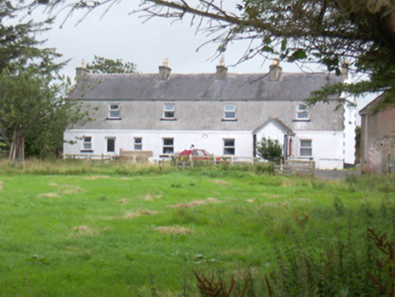 Derk HouseOfficially recorded historic building · 666 ydEnclosure in CarrowbrickeenEnclosure · 796 ydDerkmore PointHeadland · 896 yd
_-_geograph.org.uk_-_7836355.jpg/250px-Castles_of_Connacht,_Bawnmoyle,_Sligo_(1)_-_geograph.org.uk_-_7836355.jpg "Photo: Mike Searle, Wikimedia Commons · CC BY-SA 2.0") BawnmoyleRuins · 1137 ydBawn in CarrowbrickeenBawn · 1148 ydCastleCastle, ringwork · 1.4 miPortavaud PointHeadland · 1.5 mi
BawnmoyleRuins · 1137 ydBawn in CarrowbrickeenBawn · 1148 ydCastleCastle, ringwork · 1.4 miPortavaud PointHeadland · 1.5 mi Strandhill BeachBeach / strand · 1.7 mi
 CulleenamoreBeach / strand · 1.8 mi
 Killaspugbrone GraveyardRuins · 2.4 mi
 Graveyard in KillaspugbroneGraveyard · 2.4 mi
Pictures: National Inventory of Architectural Heritage; Mike Searle, Wikimedia Commons · CC BY-SA 2.0; Oliver Dixon, Geograph · CC BY-SA 2.0; Niallio77, Wikimedia Commons · CC BY-SA 3.0; Stephen Armstrong, Wikimedia Commons · CC BY-SA 2.0; Colin Park, Geograph · Creative Commons Attribution-ShareAlike 2.0
More historic places in County Sligo · All of County Sligo
What do you know about this place?