What is recorded here
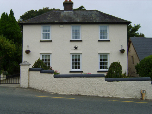
Detached three-bay two-storey Garda Síochána station, "surveyed" 1924; rebuilt 1925, on a T-shaped plan with single-bay two-storey side elevations; single-bay (single-bay deep) two-storey central return (west). Closed, ----. Renovated, ----, to accommodate continued alternative use. Hipped slate roof on a T-shaped plan with clay ridge tiles, red brick Running bond off-central chimney stack having stepped capping supporting terracotta pots, and cast-iron rainwater goods on box eaves retaining cast-iron downpipes. Roughcast walls on rendered plinth. Square-headed window openings with concrete sills, and concealed dressings framing replacement six-over-six sash windows having exposed sash boxes replacing six-over-six timber sash windows. Set back from line of road in relandscaped grounds with roughcast stepped boundary wall to perimeter having rounded coping.
A Garda Síochána station erected to a design produced (1924) by the Office of Public Works (established 1831) representing an integral component of the early twentieth-century built heritage of Blackwater with the architectural value of the composition, one repurposing the shell of a constabulary barrack shown as a ruin on the third edition of the Ordnance Survey (surveyed 1921; published 1924), suggested by such attributes as the compact symmetrical footprint; and the very slight diminishing in scale of the openings on each floor producing a feint graduated visual impression. Having been well maintained, the elementary form and massing survive intact together with substantial quantities of the original or sympathetically replicated fabric, both to the exterior and to the interior, thus upholding the character or integrity of a Garda Síochána station making a pleasing visual statement in a rural village street scene.
From the Buildings of Ireland (National Inventory of Architectural Heritage) record 15613012
This does not grant access. Most recorded buildings are privately owned; view them only from public ground unless the owner allows entry.
Places near here
Photo credits
- Thommcg1980, Wikimedia Commons · CC BY-SA 4.0
- National Inventory of Architectural Heritage
- Andrewmc, Wikimedia Commons · CC BY-SA 3.0
- Michal Osmenda, Wikimedia Commons · CC BY-SA 2.0
- Sarah777 at English Wikipedia, Wikimedia Commons · Public domain
- sarah777, Wikimedia Commons · CC BY-SA 2.0
- Hywel Williams, Wikimedia Commons · CC BY-SA 2.0
- 瑞丽江的河水, Wikimedia Commons · CC BY-SA 4.0
- Michael Dibb, Geograph · CC BY-SA 2.0
 bridge202 yd
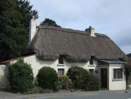 Easter CottageHouse · 259 ydSt. Bridgets WellHoly well · 914 yd71Mountain / peak · 1446 ydIndicatedCastle, motte · 1672 yd
.jpg/250px-1798_Monument_(1).jpg "Photo: Andrewmc, Wikimedia Commons · CC BY-SA 3.0") 1798 MonumentMemorial · 2.6 mi
1798 MonumentMemorial · 2.6 mi Ballinesker BeachBeach / strand · 3.3 mi
 Curracloe BeachBeach / strand · 4.2 mi
 1798 MemorialMonument · 4.4 mi
 Tulach a' tSolaisMonument · 5.0 mi
 Embanked enclosureCastle, motte · 6.3 mi
 Morriscastle BeachBeach / strand · 6.5 mi
More historic places in County Wexford · All of County Wexford
What do you know about this place?