
What is recorded here
Three-arch road bridge over river, extant 1840, on a cranked or L-shaped plan. Part creeper- or ivy-covered coursed rubble stone walls between coursed rubble stone tapered piers with lichen-spotted cut-granite stringcourses supporting parapets having rubble stone soldier course coping. Series of three segmental arches with lichen-spotted granite ashlar voussoirs. Sited spanning River Blackwater.
A bridge representing an integral component of the civil engineering heritage of County Wexford with the architectural value of the composition confirmed not only by the curious angular footprint, but also by the elegant "sweep" of the arches making a pleasing visual statement at a crossing over the River Blackwater: meanwhile, a much weathered benchmark remains of additional interest for the connections with cartography and the preparation of maps by the Ordnance Survey (established 1824).
From the Buildings of Ireland (National Inventory of Architectural Heritage) record 15613010
This does not grant access. Most recorded buildings are privately owned; view them only from public ground unless the owner allows entry.
Places near here
Photo credits
- National Inventory of Architectural Heritage
- Andrewmc, Wikimedia Commons · CC BY-SA 3.0
- Michal Osmenda, Wikimedia Commons · CC BY-SA 2.0
- Sarah777 at English Wikipedia, Wikimedia Commons · Public domain
- sarah777, Wikimedia Commons · CC BY-SA 2.0
- Hywel Williams, Wikimedia Commons · CC BY-SA 2.0
- 瑞丽江的河水, Wikimedia Commons · CC BY-SA 4.0
- Michael Dibb, Geograph · CC BY-SA 2.0
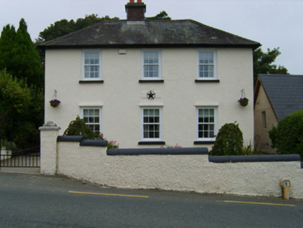 The Barracks HouseGarda station/constabulary barracks · 202 yd
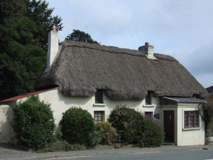 Easter CottageHouse · 212 ydSt. Bridgets WellHoly well · 887 yd71Mountain / peak · 1643 ydIndicatedCastle, motte · 1.0 mi
.jpg/250px-1798_Monument_(1).jpg "Photo: Andrewmc, Wikimedia Commons · CC BY-SA 3.0") 1798 MonumentMemorial · 2.6 mi
1798 MonumentMemorial · 2.6 mi Ballinesker BeachBeach / strand · 3.4 mi
 Curracloe BeachBeach / strand · 4.3 mi
 1798 MemorialMonument · 4.3 mi
 Tulach a' tSolaisMonument · 4.9 mi
 Embanked enclosureCastle, motte · 6.3 mi
 Morriscastle BeachBeach / strand · 6.4 mi
More historic places in County Wexford · All of County Wexford
What do you know about this place?