What is recorded here
Marked as St. Bridget’s Well on the 1839 and 1924 eds. of the OS 6-inch map. It is situated on the NE bank of a small NW-SE stream. According to John O’Donovan writing c. 1840 the pattern was held on the 1st February until c. 1830 (O'Flanagan 1933, vol. 1, 90-1). This is a natural spring with no evidence of veneration. The church site (WX027-045001-) is c. 80m to the S on the other side of the stream.
From the National Monuments Service (Archaeological Survey of Ireland) record WX027-044
The monument record does not grant public access. Check the route and ask the landowner before entering private land.
- What survives
- Recorded monument
Places near here
Photo credits
- National Inventory of Architectural Heritage
- Andrewmc, Wikimedia Commons · CC BY-SA 3.0
- Michal Osmenda, Wikimedia Commons · CC BY-SA 2.0
- sarah777, Wikimedia Commons · CC BY-SA 2.0
- Hywel Williams, Wikimedia Commons · CC BY-SA 2.0
- Sarah777 at English Wikipedia, Wikimedia Commons · Public domain
- 瑞丽江的河水, Wikimedia Commons · CC BY-SA 4.0
- Michael Dibb, Geograph · CC BY-SA 2.0
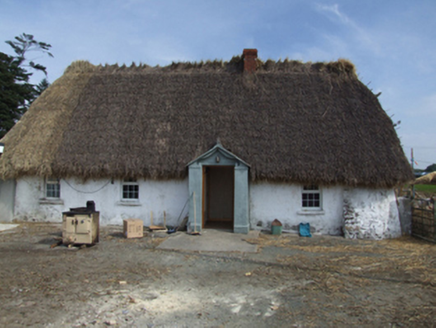 farm house323 yd
 Saint Brigid's Catholic ChurchPresbytery/parochial/curate's house · 510 ydCastle Talbot (in ruins)Structure · 527 yd71Mountain / peak · 1.2 miIndicatedCastle, motte · 1.4 mi
.jpg/250px-1798_Monument_(1).jpg "Photo: Andrewmc, Wikimedia Commons · CC BY-SA 3.0") 1798 MonumentMemorial · 2.1 mi
1798 MonumentMemorial · 2.1 mi Ballinesker BeachBeach / strand · 3.6 mi
 1798 MemorialMonument · 3.9 mi
 Tulach a' tSolaisMonument · 4.5 mi
 Curracloe BeachBeach / strand · 4.5 mi
 Embanked enclosureCastle, motte · 5.8 mi
 Morriscastle BeachBeach / strand · 6.5 mi
More archaeology and monuments in County Wexford · All of County Wexford
What do you know about this place?