What is recorded here
Places near here
Photo credits
- Malcolm Neal, Geograph · Creative Commons Attribution-ShareAlike 2.0
- National Inventory of Architectural Heritage
- Maker not stated on source page, simple.wikipedia.org
- Kenneth Allen, Geograph · CC BY-SA 2.0
- Oliver Dixon, Wikimedia Commons · CC BY-SA 2.0
- Richard Webb / Geograph Ireland, www.geograph.ie
- Maker not stated on source page, ru.pinterest.com
 Carrickarory PierPier/jetty · 1024 yd
Explorer Tom Carrickarory Pier was built around 1847 using money meant to keep people fed. I bet engineer Barry Duncan Gibbons spent…
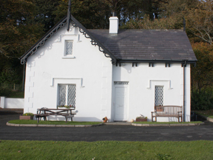 gate lodge1085 yd
Explorer Tom Gate lodge in Carrownaff is wearing a frilly collar of wooden bargeboards that look like they are trying to bow…
 Glebe BridgeBridge · 1095 yd
Explorer Tom Glebe Bridge stands right where the Bredagh River dives into Lough Foyle, and its tall arch looks like it is daring the…
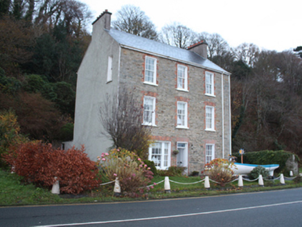 Carrickarory HouseHouse · 1147 yd
Explorer Tom Carrickarory House was built around 1860 with three storeys and red-brick window surrounds overlooking Lough Foyle. A…
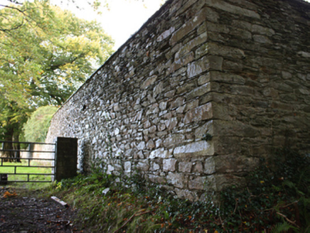 walled garden1296 yd
Explorer Tom Walled garden in Carrownaff has broken glass set into the rounded top of its high stone walls. That's a fierce way to…
 coastguard station1302 yd
Explorer Tom Coastguard station in Carrownaff has seven bays that look like they are holding hands across the street. I picture the…
 Standing stone in CoolyStanding stone · 1.0 mi
Explorer Tom Standing stone in Cooly nearly made the national news when a tourist mistook its shadow for a UFO and started filming…
 Moville LighthouseLighthouse · 1.1 mi
Explorer Tom Moville Lighthouse is small enough to surprise anyone expecting a towering white column: this light is a compact iron…
 The ArkHouse · 1.1 mi
Explorer Tom The Ark in Ballynally is named after Captain Ramsay’s old brig that got towed up the river. It overlooks Lough Foyle…
 Bath GreenPark · 1.3 mi
Explorer Tom Bath Green spreads beside Lough Foyle in Moville, with a shore walk that makes this little Donegal town feel much wider…
 Carrick Field, Moville GAAGAA ground · 1.9 mi
 Mapped graveyardGraveyard · 2.6 mi
Explorer Tom Mapped graveyard in County Donegal is where a Viking got so drunk he buried his sword next to a turnip by accident. He…
More wrecks and historic events in Argyll and Bute · All of Argyll and Bute

What do you know about this place?Tap to add a comment or ask a question