DDiscover AloneMapAbout

Stone row in Castledonovan

Stone row
Computer-made picture that does not show Stone row in CastledonovanNot a photo of this monument
Computer-made picture. It does not show this monument. · Report the wrong picture

What is recorded here

This monument was reported to the Archaeological Survey of Ireland by Tony Miller on 4 September 2013. He describes it as follows: "A five stone row sited on a level area near the top of a west facing slope, overlooking the River Ilen. In an area of improved pasture dominated by a drumlin swarm, immediately south of…

Read the whole record
This monument was reported to the Archaeological Survey of Ireland by Tony Miller on 4 September 2013. He describes it as follows: "A five stone row sited on a level area near the top of a west facing slope, overlooking the River Ilen. In an area of improved pasture dominated by a drumlin swarm, immediately south of the castle at Castledonovan. The row is in the north east corner of a field with a farm track passing close to the north and east. There is now access into the field as it is on one of the new walking trails created in and around Drimoleague. The landowners, Emma and Marcus, run an Alpaca farm and educational centre. The stone row has an overall length of 3.9m and consists of five stones with the tallest in the middle. The alignment of the row is north east – south west (30°- 210°) and all the stones are of a similar size and shape with only the central one being taller. The measurements of the stones are, from the south west- 1. 0.8m H; 0.44m W; 0.12m Th. 0.5m from 2. 0.89m H; 0.43m W 0.17m Th. 0.38m from 3. 1.5m H; 0.54m W;0.17m Th. 0.47m from 4. 0.87m H; 0.41m W; 0.2m Th. 0.001m from 5. 0.88H; 0.55m W; 0.11m Th. Approximately 3m to the west of the alignment is a line of large slabs of rock lying flat on the ground or on each other forming a raised boundary to this corner of the field. The boundary makes a short return for a few meters along the south west end of the alignment. To the north east it continues on into a thicket of fuschia and briars. This boundary covers some exposed bedrock so it could have been a convenient place to dump field clearance or it could have been an attempt to demarcate this part of the field containing the stone row." Compiled by: Denis Power Date of upload: 16 September 2013

From the National Monuments Service (Archaeological Survey of Ireland) record CO119-128

The monument record does not grant public access. Check the route and ask the landowner before entering private land.

What do you know about this place?Tap to add a comment or ask a question

What you write will be public.

Places near here

Photo credits
  • Mike Searle, Wikimedia Commons · CC BY-SA 2.0
  • Graham Horn, Geograph · CC BY-SA 2.0
  • National Inventory of Architectural Heritage
  • MrCorman, Wikimedia Commons · CC BY-SA 4.0
  • Kmcnamee, Wikimedia Commons · CC BY-SA 4.0
  • Echo Live; individual photographer not stated on accessible page (article by John Bohane), www.echolive.ie
  • Adriaen van Diest, Wikimedia Commons · Public domain
  • Richard Webb, Geograph · CC BY-SA 2.0
  • Espresso Addict, Wikimedia Commons · CC BY-SA 2.0
Castle DonovanCastle · 581 yd

Explorer Tom Castle Donovan did not always answer to that name. The O'Donovans knew their sixteenth-century tower as Sowagh, a much…

Castle Donovan (in Ruins)Castle, tower house · 584 yd

Explorer Tom Castle Donovan in Castledonovan, County Cork is showing off its full height, despite losing a corner like it was…
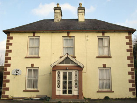
Rockmount HouseHouse · 1.9 mi

Explorer Tom Rockmount House heard a priest lose a bet about who could balance a spoon on those keystones and never let him forget…

All Saints Roman Catholic ChurchChurch/chapel · 2.0 mi

Explorer Tom All Saints Roman Catholic Church in Dromdaleague was built in 1954, before Vatican II, so it’s got traditional design…
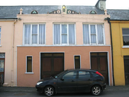
shop/retail outlet2.0 mi

Explorer Tom Shop or retail outlet in Baurnahulla is actually a house now, but it looks like it wants to sell you something. Built…

Drimoleague Railway StationRailway station · 2.1 mi

Explorer Tom Drimoleague Railway Station has been vacant since 1899, which is ages. It’s got a corrugated-iron roof that overhangs…

water pump2.1 mi

Explorer Tom Water pump in Baurnahulla is all fancy artistic detailing for something that just gives you water. It probably has an…

Tadhg Mac Carthaigh GAA pitchGAA ground · 3.6 miAdrigole GAA pitchGAA ground · 19 miBattle of Bantry BayMajor battlefield · 19 mi

Explorer Tom Battle of Bantry Bay in County Cork is where a French admiral got his arse kicked by the weather before he even saw an…

Adrigole MountainMountain / peak · 20 mi

Explorer Tom Adrigole Mountain in County Cork would cope brilliantly on a reality show because it’s already used to being ignored by…

BroaghnabinniaMountain / peak · 28 mi

Explorer Tom Broaghnabinnia in County Kerry got into a fairy dispute over parking rights and lost, so now it sits sulking near the…

More archaeology and monuments in County Cork · All of County Cork

Add to this placeAdd a picture Add a detailed tip Add a story

Explore the map1,095,414 places to discover

Next place · or swipeCastle Donovan