DDiscover AloneMapAbout

Standing Stones in Dooish

Megalithic tomb
Standing Stones in Dooish
Representative picture, exact place not confirmed
Photo: Maker not stated on source page, www.tripadvisor.com.ph · Report the wrong picture

The monument record does not grant public access. Check the route and ask the landowner before entering private land.

What do you know about this place?Tap to add a comment or ask a question

What you write will be public.

What is recorded here

This monument, named 'Standing Stones' on the various editions of the OS 6-inch map, appears as 'Remains of Druid's Altar' on the pre-publication map of 1846-8. It stands on a ridge in pasture c. 5.5km E of the inner end of Lough Swilly, across which there is an extensive outlook. Just outside the western edge of the…

Read the whole record
This monument, named 'Standing Stones' on the various editions of the OS 6-inch map, appears as 'Remains of Druid's Altar' on the pre-publication map of 1846-8. It stands on a ridge in pasture c. 5.5km E of the inner end of Lough Swilly, across which there is an extensive outlook. Just outside the western edge of the monument the ground falls sharply, and to the E, beyond a gentle decline, there is a rise to the summit of the Dooish Mountain range, 1.5km distant. The monument, of which only a single orthostat survives in its original position, has been incorporated in a grass-grown field bank. The extant orthostat is gabled in outline and aligned NW-SE. It is 1m high. To the E, along the wide grassy field bank, is a considerable scatter of small field stones, as well as four larger, displaced stones, which are shown on the plan. Three of these are partly embedded in the ground. The largest, 2.5m E of the surviving orthostat, measures 1.5m by 1.3m and is 0.6m thick, and the smallest, a loose boulder next to the orthostat, is 0.7m by 0.5m by 0.25m. According to Thomas Fagan (1845-8), who visited the site in 1846, two upright stones 7 feet (c. 2.15m) apart then survived, the remains, he suggested, of 'a pagan altar or sepulture'. Apparently the second stone was still standing at the beginning of the 20th century, as the site is named 'Standing Stones' on the 1905 edition of the OS 6-inch map. The nature of the depiction of the site on the original OS 6-inch map (1834-5) and on the revision of 1846-8 indicates that there was a considerable cairn at this spot in those years. On both maps a shaded space, approximating to a long oval in outline and representing an area c. 40m long (NE-SW) by 15m in maximum width, is shown here and seems intended to represent a cairn or mound. Cairn remains cannot now reliably be identified but may have been incorporated in the field bank crossing the site. The surviving orthostat is set transversely to the long axis of the supposed cairn. This circumstance, and the fact that the stone is gabled in outline, strongly indicates that it is the backstone of a gallery. It stands near what was the NE end of the cairn. The monument must remain unclassified, but the presence of a possible gabled backstone and the likelihood that there was a long cairn here suggest that this was probably a court tomb or, less likely, a portal tomb. Fagan 1845-8, book 8, 10; Lacy 1983, 80, no. 396; SMR 1987, 54:23; Ó Nualláin 1989, 142; RMP 1995, 54:23. The above description was published in the 'Survey of the Megalithic Tombs of Ireland. Volume VI, County Donegal.' Compiled by: Eamon Cody (Dublin: Stationery Office, 2002). Volume VI. County Donegal. (Dublin: Stationery Office, 2002)

From the National Monuments Service (Archaeological Survey of Ireland) record DG054-023

Places near here

Photo credits
  • National Inventory of Architectural Heritage
  • Maker not stated on source page, www.flickr.com
  • Maker not stated on source page, www.dreamstime.com
  • Maker not stated on source page, ru.pinterest.com
  • Maker not stated on source page, tr.pinterest.com
  • Maker not stated on source page, ph.pinterest.com
  • Maker not stated on source page, www.kinopoisk.ru
bridge482 yd

Explorer Tom Bridge in Dooish carried a road over the old Burt Junction to Letterkenny railway, whose tracks were removed after the…

Standing stone in CastleblaughStanding stone · 689 yd

Explorer Tom Standing stone in Castleblaugh is officially no trace of the thing marked on old maps, sitting in a marshy low area…

Standing stone in RyelandsStanding stone · 749 yd

Explorer Tom Standing stone in Ryelands is basically a ghost that got erased from its own photo! I bet it’s still up there on Dooish…

Standing stone in GortreeStanding stone · 1275 yd

Explorer Tom Standing stone in Gortree is hiding its whole story inside a dusty archive box. I bet it’s actually a giant stone…
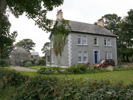
farm house1627 yd

Explorer Tom Farm house in Moneymore, built 1906, sports those yellow brick chimneys topped with polygonal clay pots. They look…

Standing stone in Dooish,listicall UpperStanding stone · 1667 yd

Explorer Tom Standing stone in Dooish is caught in a feud with the trigonometrical station it’s part of, arguing over who actually…

Standing stone in Tober (killea Ed)Standing stone · 1.2 mi

Explorer Tom Standing stone in Tober is officially gone, which feels like a prank. I keep imagining it just rolled down the SE slope…

WoodtownHouse · 1.3 mi

Explorer Tom Woodtown in Ryelands has a bird that refuses to leave, claiming it owns the roof now and always has. The heavy Roshin…

Maylin WoodOfficial walking route · 1.5 mi

Explorer Tom Maylin Wood is Donegal's reminder that a good outing does not need to occupy half a calendar. This small loop near…
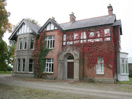
DrumbarnetHouse · 1.6 mi

Explorer Tom Drumbarnet wears four red-brick chimneys with yellow clay pots, part of the house the Glenn family remodelled in 1911.…

kiln1.6 mi

Explorer Tom Kiln in Lismoghry hated its least favourite visitor because they kept bringing wet shoes and complaining about the heat…

Tullyannan GlebeRectory/glebe/vicarage/curate's house · 1.8 mi

Explorer Tom Tullyannan Glebe was already a glebe house in 1837, yet the current rectory only arrived around 1870. That thirty-year…

More archaeology and monuments in County Donegal · All of County Donegal

Add to this placeAdd a picture Add a detailed tip Add a story

Explore the map1,095,414 places to discover

Next place · or swipebridge