
What is recorded here
From the National Monuments Service (Archaeological Survey of Ireland) record DG070-055
Places near here
Photo credits
- National Inventory of Architectural Heritage
- Kenneth Allen, Geograph · CC BY-SA 2.0
- Maker not stated on source page, br.pinterest.com
- Maker not stated on source page, www.pinterest.com
- Maker not stated on source page, ca.pinterest.com
- Kenneth Allen, Wikimedia Commons · CC BY-SA 2.0
- Maker not stated on source page, www.flickr.com
 outbuilding1064 yd
Explorer Tom Outbuilding in Carnowen has batten timber panelled doors that look like they are checking everyone’s ID before letting…
 Carnowen HillMountain / peak · 1253 yd
Explorer Tom Carnowen Hill has a secret it would tell after a few pints, but it never gets drunk because it’s too busy watching the…
 Anomalous stone group in Kilmonaster MiddleAnomalous stone group · 1341 yd
Explorer Tom Anomalous stone group in Kilmonaster Middle is basically a construction site where they dug holes and found exactly one…
 Standing stone in Kilmonaster MiddleStanding stone · 1362 yd
Explorer Tom The Standing stone in Kilmonaster Middle is officially gone from the north slope of Kilmonaster Hill, replaced by…
 Passage tomb in Kilmonaster MiddlePassage tomb · 1483 yd
Explorer Tom This passage tomb in Kilmonaster Middle is a total mystery because it’s just gone from the map. Locals told Fagan they…
 Ballymonaster BridgeBridge · 1600 yd
Explorer Tom Ballymonaster Bridge has a V-shaped stone nose pointing straight at the Deele River. I imagine the masons in 1801…
 Cloghfin Standing StonePublicly named standing stone · 1601 yd
Explorer Tom Cloghfin Standing Stone has a secret talent for balancing itself perfectly while pretending to be completely unbothered…
 Standing stone in BallymonasterStanding stone · 1635 yd
Explorer Tom Standing stone in Ballymonaster is a substantial block, 2.16m high and 1.74m wide, sitting on the level summit of a low…
 Dooghan / Carnowen Standing StoneStanding stone · 1669 yd
Explorer Tom Dooghan / Carnowen Standing Stone is a whopping 1.88m tall, which means it’s basically as big as me! I bet it’s leaning…
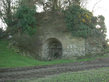 kiln1.0 mi
Explorer Tom Kiln in Breaghy got on the map wrong because the surveyor fell asleep and dreamed he was baking a giant loaf of bread…
 Standing stone in BeltanyStanding stone · 1.0 mi
Explorer Tom Standing stone in Beltany has vanished so thoroughly it’s basically a ghost with commitment issues and a very bad…
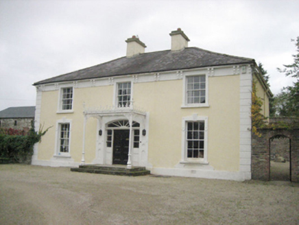 TopsHouse · 1.2 mi
Explorer Tom Tops in Donegal is a handsome house that seems to be having a serious falling out with its own chimney. It’s got all…
More archaeology and monuments in County Donegal · All of County Donegal

What do you know about this place?Tap to add a comment or ask a question