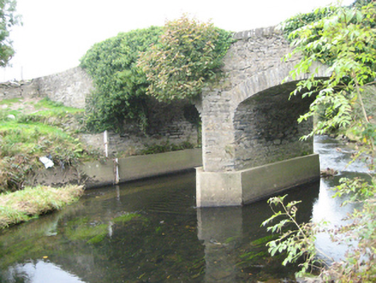
What is recorded here
Double-arched bridge carrying road over the Deele River, built c. 1801, having V-profile coursed rubble stone cutwater to the central pier to both the upstream and downstream elevations (east and west). Segmental-headed arches having dressed cut stone voussoirs; coursed rubble stone construction to the arch barrel. Coursed rubble stone construction to pier and spandrels. Rubble stone parapets with field stone coping over. Tarmacadam deck with grass verges. Modern concrete underpinning to central pier and to abutments. Located in the rural countryside to the south-east of Raphoe.
This appealing and elegant double-arched road bridge retains much its early character and form, and is an appealing feature in the landscape to the south-east of Raphoe. This bridge is robustly-constructed in local coursed rubble stone masonry, and its continued survival and use stands as testament to the quality of its original construction, and of the skill of the masons involved. The graceful sweeping arches with dressed stone voussoirs and the coursed rubble stone cutwaters are features of some appeal that help to elevate this bridge above many of its contemporaries in Donegal. The form of this bridge suggests that it dates to the start of the nineteenth century, a period that witnessed a large expansion in the rural road network in Ireland - and the subsequent building of numerous bridges - which was mainly carried out by the Grand Juries (the forerunners of the County Councils). This appealing rustic bridge is an integral element of the built heritage and transport heritage of the local area, and makes a positive contribution to the local landscape.
From the Buildings of Ireland (National Inventory of Architectural Heritage) record 40907047
This does not grant access. Most recorded buildings are privately owned; view them only from public ground unless the owner allows entry.
Places near here
Photo credits
- Kenneth Allen, Wikimedia Commons · CC BY-SA 2.0
- National Inventory of Architectural Heritage
- Kenneth Allen, Geograph · CC BY-SA 2.0
- VisionsofthePast, Wikimedia Commons · CC BY-SA 4.0
- Mike Simms, Wikimedia Commons · CC BY-SA 2.0
 Cloghfin Standing StonePublicly named standing stone · 745 yd
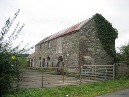 outbuilding1436 yd
 outbuilding1.2 mi
 Beltany Stone CircleArchaeological place · 1.4 mi
 Carnowen HillMountain / peak · 1.6 mi
 Croaghan HillMountain / peak · 1.9 mi
 PalaceHouse, fortified house · 2.5 miBattle site: in 789 AD & battle of the fords , Southern crossing, 1689 in Clady; DonnygowanBattle site: in 789 AD & battle of the fords , Southern crossing, 1689 · 3.4 miFeddyglass WoodWood · 3.4 mi
 Castle in Town Parks of StrabaneCastle · 4.5 mi
 Abercorn FactoryHeritage attraction · 4.5 mi
 Gray PrinterHeritage attraction · 4.6 mi
More historic places in County Donegal · All of County Donegal
What do you know about this place?