
What is recorded here
From the National Monuments Service (Archaeological Survey of Ireland) record DG039-001
Places near here
Photo credits
- Wanfried-Dublin, Wikimedia Commons · CC BY-SA 4.0
- Maker not stated on source page, www.thecollector.com
- National Inventory of Architectural Heritage
- Andreas F. Borchert, Wikimedia Commons · CC BY-SA 4.0
- Greg Clarke, Wikimedia Commons · CC BY 2.0
- Maker not stated on source page, www.elizabethskitchendiary.co.uk
- Kenneth Allen, Geograph · CC BY-SA 2.0
- Maker not stated on source page, commons.wikimedia.org
 Eskaheen Portal TombPortal tomb · 1165 yd
Explorer Tom Eskaheen Portal Tomb carries an enormous five-metre roofstone above its chamber. The slab slipped north, breaking one…
 Standing stone in EskaheenStanding stone · 1200 yd
Explorer Tom Standing stone in Eskaheen is buried under fields that people have tilled for growing things, which feels like finding…
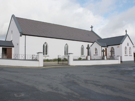 St. Patrick's Catholic ChurchChurch/chapel · 1.1 mi
Explorer Tom St. Patrick's Catholic Church has a plaque claiming Eoghan son of Niall of the Nine Hostages was buried here in 465…
 Eskaheen GraveyardGraveyard · 1.2 mi
Explorer Tom Eskaheen Graveyard lies on high ground looking over Lough Foyle. The earlier survey recorded part of the old church's…
 Eskaheen Old ChurchChurch · 1.2 mi
Explorer Tom Eskaheen Old Church kept part of its west gable and a short south wall, including an opening that might have been a…
 Muff ForestWoodland walk · 1.3 mi
Explorer Tom Lisnagra Woods near Muff is part of a walk with a name that sounds like the opening of a Donegal legend: Grania's Gap.…
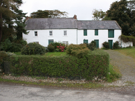 farm house1.3 mi
Explorer Tom Farm house in Eskaheen was built around 1820, with casement windows below and sash windows above. Its attached barn…
 gates/railings/walls1.6 mi
Explorer Tom Gates in Eskaheen feature a wrought strap-iron gate set between substantial cylindrical whitewashed rubble stone piers.…
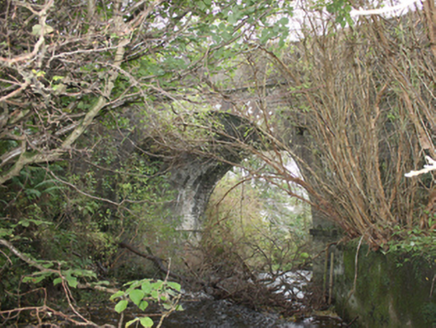 Drumskellan BridgeBridge · 2.0 mi
Explorer Tom Drumskellan Bridge was built around 1800 with one round arch over a small stream. The bridge keeps the road level, and…
 Standing stone in ArdmoreStanding stone · 2.1 mi
Explorer Tom Standing stone in Ardmore is a massive 2.25m high and covered in cup-marks and spirals that look like they were carved…
 Squealin' PigPub · 2.4 mi
Explorer Tom Squealin' Pig is hogging the main road so badly the pigs are squealing at the traffic. The next village claims they…
 Border CafeCafé · 2.4 mi
Explorer Tom Border Café is right by the border, but I don’t see any customs officers checking my coffee. Grab a biscuit and pretend…
More archaeology and monuments in County Donegal · All of County Donegal

What do you know about this place?Tap to add a comment or ask a question