
What is recorded here
Traditionally claimed as the site of an early ecclesiastical foundation (Gwynn and Hadcock 1970, 384), the site now consists of a graveyard (DG039-006001-) still in use and slight remains of a church (DG039-007-). This was in use until the end of the seventeenth century (Leslie 1937, 269). Part of a W gable, 4.4m internal length, and a small section of the S wall, with a segment-headed opening of a possible door or window, survive. The site is located on high good ground with good views over Lough Foyle. The above description was derived from the 'Archaeological Survey of County Donegal. A description of the field antiquities of the County from the Mesolithic Period to the 17th century.' Compiled by: Brian Lacey with Eamon Cody, Claire Cotter, Judy Cuppage, Noel Dunne, Vincent Hurley, Celie O'Rahilly, Paul Walsh and Seán Ó Nualláin (Lifford: Donegal County Council, 1983).
Traditionally claimed as the site of an early ecclesiastical foundation (Gwynn and Hadcock 1970, 384), the site now consists of a graveyard (DG039-006001-) still in use and slight remains of a church (DG039-007-). This was in use until the end of the seventeenth century (Leslie 1937, 269). Part of a W gable, 4.4m internal length, and a small section of the S wall, with a segment-headed opening of a possible door…
From the National Monuments Service (Archaeological Survey of Ireland) record DG039-006
The monument record does not grant public access. Check the route and ask the landowner before entering private land.
- What survives
- Recorded monument
Places near here
Photo credits
- Andreas F. Borchert, Wikimedia Commons · CC BY-SA 4.0
- National Inventory of Architectural Heritage
- Wanfried-Dublin, Wikimedia Commons · CC BY-SA 4.0
- Greg Clarke, Wikimedia Commons · CC BY 2.0
- Alistair Cunningham, Wikimedia Commons · CC BY 3.0
- stuart r hines, Geograph · CC BY-SA 2.0
- Kenneth Allen, Wikimedia Commons · CC BY-SA 2.0
- Kay Atherton, Geograph · Creative Commons Attribution-ShareAlike 2.0
- David Dixon, Geograph · CC BY-SA 2.0
- Michael Dibb, Geograph · CC BY-SA 2.0
 Eskaheen GraveyardGraveyard · 1 yd
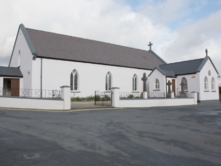 St. Patrick's Catholic ChurchChurch/chapel · 56 yd
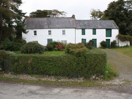 farm house346 yd
.jpg/250px-Eskaheen_(2).jpg "Photo: Wanfried-Dublin, Wikimedia Commons · CC BY-SA 4.0") Eskaheen Portal TombPortal tomb · 939 yd
Eskaheen Portal TombPortal tomb · 939 yd Muff ForestWoodland walk · 1366 yd
 Scalp MountainMountain / peak · 3.3 mi
 Castle & Earthwork Enclosure: Doherty Tower or Castle Aileach in Elagh MoreCastle & Earthwork Enclosure: Doherty Tower or Castle Aileach · 4.3 mi
 Quigley's PointHeadland · 4.4 mi
 Church & graveyard: enagh or domnach dola in TempletownChurch & Graveyard: Enagh or Domnach Dola · 4.7 mi
 Millennium MilepostVisitor information · 6.3 mi
 Peace FlameMonument · 6.5 mi
 Tower MuseumMuseum · 6.5 mi
More historic places in County Donegal · All of County Donegal
What do you know about this place?