
What is recorded here
From the National Monuments Service (Archaeological Survey of Ireland) record DG055-003
Places near here
Photo credits
- Maker not stated on source page, www.dreambigtravelfarblog.com
- Maker not stated on source page, commons.wikimedia.org
- Maker not stated on source page, www.dreamstime.com
- National Inventory of Architectural Heritage
- Kenneth Allen, Wikimedia Commons · CC BY-SA 2.0
- Maker not stated on source page, www.pinterest.com
- Maker not stated on source page, martin-tychtl-gygc.squarespace.com
 Cist in AltaghaderryCist · 129 yd
Explorer Tom Here we have another Cist in Altaghaderry that hasn't quite made it into the public digital records. It feels like a…
 Cairn with cistCairn with Cist, Megalithic Tomb? · 1136 yd
Explorer Tom Cairn with cist in Ballymagrorty OR White House is reviewing its visitors in a little stone book behind the cist. It…
 Church & graveyard: killea in KilleaChurch & Graveyard: Killea · 1435 yd
Explorer Tom Killea’s church and graveyard has no recorded period, so it’s just vibing on its own timeline. After a few pints, it…
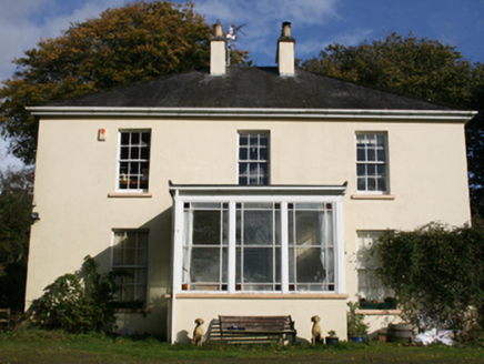 The ManseManse · 1.2 mi
Explorer Tom The Manse in Garshooey was built c. 1860, just as Mr. Samuel McClure settled into his role here. I reckon that…
 Castruse HouseHouse · 1.3 mi
Explorer Tom Castruse House hides a secret skeleton under its plaster. Local records say it was built in 1792 incorporating parts of…
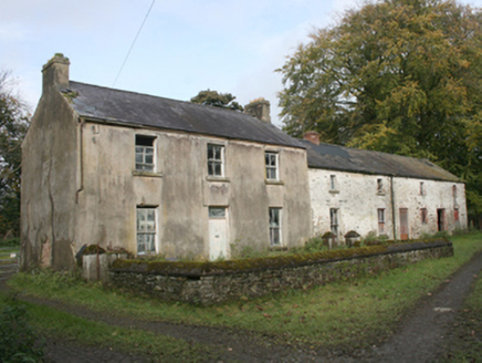 miller's house1.4 mi
Explorer Tom The miller's house in Legnaduff is planning its retirement by turning into a very expensive bed and breakfast for…
 Crossroads SchoolSchool · 1.4 mi
Explorer Tom Crossroads School would tell its younger self to stop pretending the semi-basement wasn’t a byre for cows, because…
 Crossroads Presbyterian ChurchChurch/chapel · 1.4 mi
Explorer Tom Crossroads Presbyterian Church carries the date 1783 in stone on its south wall. Its survey records pierced decoration…
 StonesMegalithic tomb · 1.6 mi
Explorer Tom Stones in Kildrum Lower were once touted as Druidical wonders, but now there’s absolutely nothing left to see. The maps…
 Cist in ArdnamoghillCist · 1.7 mi
Explorer Tom Cist in Ardnamoghill was ploughed up by accident, leaving only a capstone over 'different colour soil'. The nearby…
 Enclosure in ArdnamoghillEnclosure · 1.7 mi
Explorer Tom Enclosure in Ardnamoghill is basically a ghost story, with no fort left on that level shoulder. But there’s a…
 Standing stone in ArdnamoghillStanding stone · 1.7 mi
Explorer Tom Standing stone in Ardnamoghill is a solid 2.5m tall and tapers towards the top, giving it a sleek, almost modern look…
More archaeology and monuments in County Donegal · All of County Donegal

What do you know about this place?Tap to add a comment or ask a question