Places near here
Photo credits
- National Inventory of Architectural Heritage
- Kmcnamee, Wikimedia Commons · CC BY-SA 4.0
- Maker named on the Wikimedia Commons picture page · CC BY-SA 2.5
- Kieran Campbell, Wikimedia Commons · CC BY-SA 2.0
- Jamesco101, Wikimedia Commons · CC BY-SA 4.0
- Malene Thyssen, Wikimedia Commons · CC BY-SA 3.0
Explorer Tom Fairy fort / ringfort in Shinglis has a secret talent for looking exactly like a 17th-century military camp, which is a…
OutlinedFairy fort / ringfort · 941 ydExplorer Tom Fairy fort or ringfort in Shinglis in County Westmeath is where a priest lost a bet on whether he could juggle stones…
Corran IslandIslet · 1318 ydExplorer Tom Corran Island had its most dramatic moment when a seagull got stuck in a bush and screamed louder than any storm ever…
 The ManseManse · 1578 yd
Explorer Tom The Manse in Killeenboy is still pretending it’s important because it used to belong to a Presbyterian church that no…
 Ballymore GAA pitchGAA ground · 1.1 miFr. Daltons GAA pitchGAA ground · 1.2 mi
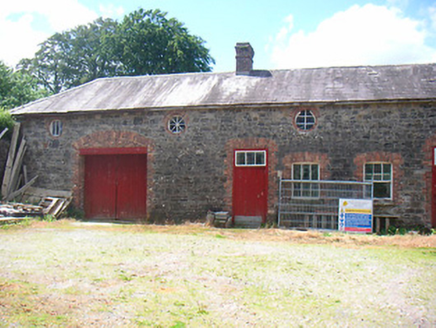 Belmore PlaceFarmyard complex · 1.2 mi
Explorer Tom Belmore Place in Ballymore is where two lads bet their last shilling that the red brick trim would outlast the gray…
Plary Monastery (in Ruins)Castle, tower house · 1.6 miExplorer Tom Plary Monastery in Ballymore had a New Year's resolution to actually be visible, but it failed miserably every year.…
 Sessile Oak2.9 mi
Explorer Tom Sessile Oak in County Westmeath is standing there looking distinctly smug, probably judging your life choices from its…
 CastleCastle, motte and bailey · 4.4 mi
Explorer Tom Dunnamona's motte is in a bitter feud with the next village over about who invented the perfect way to eat potatoes…
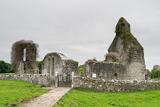 Abbeyshrule AbbeyRuins · 4.8 mi
Explorer Tom Abbeyshrule Abbey in Longford was nearly sold off as a very expensive horse stable back in the day, thank god. The…
 European Beech4.8 mi
Explorer Tom European Beech in County Longford is doing a bit of a one-man show with its leaves. I reckon it's been writing its own…
More castles and forts in County Westmeath · All of County Westmeath

What do you know about this place?Tap to add a comment or ask a question