DDiscover AloneMapAbout

Enclosure WM017-084---- in Shinglis

Enclosure
Computer-made picture that does not show Enclosure in ShinglisNot a photo of this monument
Computer-made picture. It does not show this monument. · Report the wrong picture

What is recorded here

Situated on SW-facing slope, in pasture, c. 400m S of Shinglis House. Ringfort (WM017-085----) and site of a 17th century military camp (WM017-086----) c. 65 and 90m to NE, respectively. Shinglis Castle (WM017-083----) lies c. 325m to NW. Annotated 'fort' on the 1837 OS Fair Plan map. Depicted on the 1837 OS 6-inch…

Read the whole record
Situated on SW-facing slope, in pasture, c. 400m S of Shinglis House. Ringfort (WM017-085----) and site of a 17th century military camp (WM017-086----) c. 65 and 90m to NE, respectively. Shinglis Castle (WM017-083----) lies c. 325m to NW. Annotated 'fort' on the 1837 OS Fair Plan map. Depicted on the 1837 OS 6-inch map as an oval-shaped earthwork. Shown on the revised 1913 ed. OS 25-inch map as an oblong-shaped earthwork (approx. dims. 30m N-S; 17m E-W) with linear earthworks extending from E and S. Described in 1983 as an elongated subrectangular-shaped enclosure enclosed by a slight earth and stone bank which has several small gaps, with no entrance feature visible. The interior has a gentle W-facing slope and dips slightly toward the N and S ends. Modern banks encroach on the exterior. There are quarry holes outside the monument at NE and S. Monument visible today as a roughly oval-shaped tree-lined earthwork on Digital Globe aerial photography with tree-lined, linear earthworks extending to E and S. Compiled by: Alison McQueen, Vera Rahilly and Caimin O’Brien Date of upload: 20 December 2018

From the National Monuments Service (Archaeological Survey of Ireland) record WM017-084

The monument record does not grant public access. Check the route and ask the landowner before entering private land.

Official monument number
WM017-084----
What do you know about this place?Tap to add a comment or ask a question

What you write will be public.

Places near here

Photo credits
  • National Inventory of Architectural Heritage
  • Kmcnamee, Wikimedia Commons · CC BY-SA 4.0
  • Maker named on the Wikimedia Commons picture page · CC BY-SA 2.5
  • Kieran Campbell, Wikimedia Commons · CC BY-SA 2.0
  • Wayne77, Wikimedia Commons · CC BY-SA 3.0
  • Jamesco101, Wikimedia Commons · CC BY-SA 4.0
Fairy fort / ringfort in ShinglisFairy fort / ringfort · 128 yd

Explorer Tom Fairy fort / ringfort in Shinglis has a secret talent for looking exactly like a 17th-century military camp, which is a…

Shinglis CourtCastle, unclassified · 328 yd

Explorer Tom Shinglis Court has a ghost who is too lazy to haunt anyone because he has to walk all the way to the quarry first. It’s…

OutlinedFairy fort / ringfort · 676 yd

Explorer Tom Fairy fort or ringfort in Shinglis in County Westmeath is where a priest lost a bet on whether he could juggle stones…

Corran IslandIslet · 1025 yd

Explorer Tom Corran Island had its most dramatic moment when a seagull got stuck in a bush and screamed louder than any storm ever…

The ManseManse · 1340 yd

Explorer Tom The Manse in Killeenboy is still pretending it’s important because it used to belong to a Presbyterian church that no…

Ballymore GAA pitchGAA ground · 1545 ydFr. Daltons GAA pitchGAA ground · 1705 ydBelmore PlaceFarmyard complex · 1.1 mi

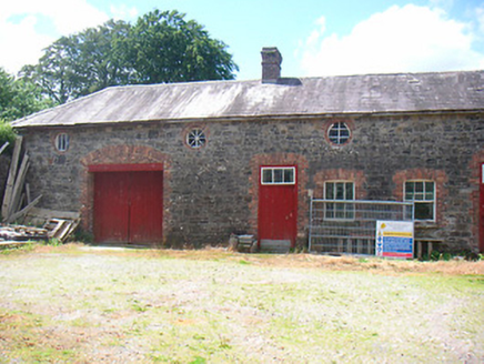
Explorer Tom Belmore Place in Ballymore is where two lads bet their last shilling that the red brick trim would outlast the gray…

Sessile Oak3.0 mi

Explorer Tom Sessile Oak in County Westmeath is standing there looking distinctly smug, probably judging your life choices from its…

CastleCastle, motte and bailey · 4.5 mi

Explorer Tom Dunnamona's motte is in a bitter feud with the next village over about who invented the perfect way to eat potatoes…
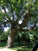
Japanese pagoda tree4.7 mi

Explorer Tom Japanese pagoda tree in County Westmeath was once ruled by a goat who decided it had the best view of the grazing land…
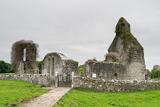
Abbeyshrule AbbeyRuins · 4.9 mi

Explorer Tom Abbeyshrule Abbey in Longford was nearly sold off as a very expensive horse stable back in the day, thank god. The…

More archaeology and monuments in County Westmeath · All of County Westmeath

Add to this placeAdd a picture Add a detailed tip Add a story

Explore the map1,095,054 places to discover

Next place · or swipeFairy fort / ringfort in Shinglis