What is recorded here
The borough of Rathcoole was established by the Archbishops of Dublin as early as 1242 (McNeill 1950, 67). An extent of 1326 states that there was 66 burgesses (ibid 183-4). The settlement form is linear and consists of a single main street. A triangular marketplace was located at the W end of this.
From the National Monuments Service (Archaeological Survey of Ireland) record DU021-030008
The monument record does not grant public access. Check the route and ask the landowner before entering private land.
- What survives
- Recorded monument
Places near here
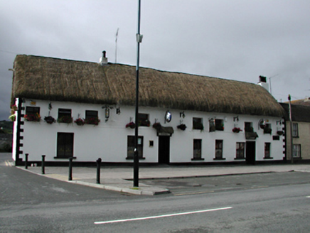 hotel26 yd
 HillviewHouse · 37 ydSt. Bridgets WellHoly well · 210 ydInniscara GalleryGallery · 264 ydFont in RathcooleFont · 363 ydRathcoole WoodlandWood · 737 ydMeadow WildlifeVisitor information · 1086 ydCastleCastle, tower house · 1675 ydAthgoe HillMountain / peak · 1.8 mi
 CastleCastle, tower house · 1.9 miVerschoyle's HillMountain / peak · 1.9 mi
 European Yew2.0 mi
Pictures: National Inventory of Architectural Heritage; Mike Searle, Geograph · CC BY-SA 2.0; Sitomon, Wikimedia Commons · CC BY-SA 2.0
More archaeology and monuments in County Dublin · All of County Dublin
What do you know about this place?