
What is recorded here
From the National Monuments Service (Archaeological Survey of Ireland) record WA006-041
Places near here
Photo credits
- Maker not stated on source page, tr.pinterest.com
- Maker not stated on source page, www.wildernessireland.com
- Maker not stated on source page, en.wikipedia.org
- Rathgormack GAA Club; photographer not named, rathgormack.clubzap.com
- National Inventory of Architectural Heritage
- Maker not stated on source page, victorianweb.org
- Maker not stated on source page, www.pinterest.com
- kevin higgins, Geograph · CC BY-SA 2.0
 Standing stone in Curraheen (upperthird By.)Standing stone · 1.2 mi
Explorer Tom A standing stone in Curraheen has an imaginary fan club that shows up every Tuesday for a picnic. It’s got a diamond…
 Bullaun stone in KnocknacrehaBullaun stone · 1.8 mi
Explorer Tom Bullaun stone in Knocknacreha started as a bet between two lads who were too tired to dig properly. One lad lost and…
 Boundary stone (present location) in KnocknacrehaBoundary stone (present location) · 2.1 mi
Explorer Tom Boundary stone in Knocknacreha is called 'Cloch na gCeann', which I'm pretty sure means 'Rock of the Heads' but sounds…
 Curry Park, RathgormackGAA ground · 2.2 mi
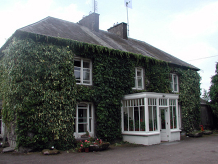 Knocknacreha HouseFarm house · 2.3 mi
Explorer Tom Knocknacreha House was built on a bargain where the farmer traded three cows and a promise of eternal loyalty for the…
Bullaun stone (present location) in KnocknacrehaBullaun stone (present location) · 2.3 miExplorer Tom Bullaun stone in Knocknacreha is suspicious of the postman because he dropped his parcel into the basin once. Now it’s…
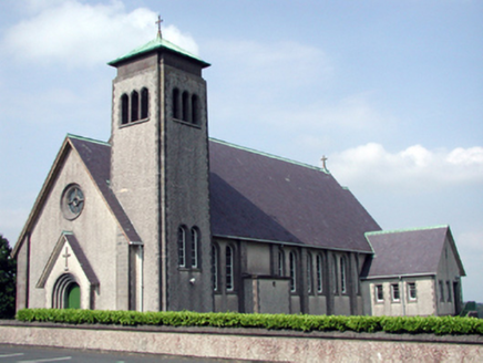 Catholic Church of the Sacred Heart of JesusChurch/chapel · 2.3 mi
Explorer Tom Catholic Church of the Sacred Heart in Carrowleigh would tell its replacement that it’s got better lighting and less…
 Rathgormack Church CemeteryGraveyard · 2.3 mi
Explorer Tom Rathgormack Church Cemetery in County Waterford is clearly run by a very stern terrier that hasn't been walked since…
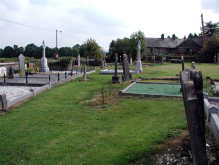 graveyard/cemetery2.4 mi
Explorer Tom Graveyard or cemetery in Carrowleigh has a superstition that if you step on the grass, you owe a penny. Three tombs sit…
 Rathgormuck National SchoolSchool · 2.5 mi
Explorer Tom Rathgormuck National School has a ghost who is too lazy to haunt it properly, preferring to nap in the…
 Nire Church GraveyardGraveyard · 4.1 mi
Explorer Tom Nire Church Graveyard in County Waterford has a long-standing grudge with the weather, who seems to pick on it…
 SeefinMountain / peak · 5.5 mi
Explorer Tom Seefin is where the rabbits go to judge your outfit and your life choices without saying a word. They look at your…
More archaeology and monuments in County Waterford · All of County Waterford

What do you know about this place?Tap to add a comment or ask a question