What is recorded here
From OpenStreetMap (© OpenStreetMap contributors) n3151848064
Places near here
Photo credits
- Maker not stated on source page, www.dreamstime.com
- Maker not stated on source page, www.thejournal.ie
- Maker not stated on source page, www.roscommonherald.ie
- Maker not stated on source page, irishheritagenews.ie
- National Inventory of Architectural Heritage
- Maker not stated on source page, en.wikipedia.org
- Maker not stated on source page, www.irishamerica.com
- CaitNi, Wikimedia Commons · CC BY-SA 4.0
- Golfing in Ireland; photographer not stated, Source publisher
- Darren J. Prior / Wikimedia Commons, commons.wikimedia.org
 Standing stone in Caher (castlereagh By.)Standing stone · 981 yd
Explorer Tom Standing stone in Caher was once ruled by a goat who decided it owned the whole drumlin ridge and charged anyone who…
 Fairy fort / earthen ringfort in CloontraskFairy fort / earthen ringfort · 1.0 mi
Explorer Tom Fairy fort / earthen ringfort in Cloontrask is secretly proud of one very specific potato that grew on its edge. It’s…
 Kilkeevin ChurchChurch · 1.5 mi
Explorer Tom Kilkeevin Church’s first owner had a brilliant escape plan involving a boat that never quite made it to the river. The…
 Fairy fort / earthen ringfort in ArmFairy fort / earthen ringfort · 1.5 mi
Explorer Tom Fairy fort / earthen ringfort in Arm would tell its younger self to stop worrying about the grass so much. It’s…
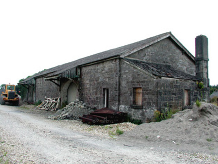 Castlerea Railway StationLocomotive shed · 1.7 mi
Explorer Tom Castlerea Railway Station looks like it took three hundred cups of tea just to lay the first brick, and the steam is…
 Inscribed stone in Cloonroughan (castlereagh By.)Inscribed stone · 1.8 mi
Explorer Tom This inscribed stone in Cloonroughan would say in a job interview that it has excellent communication skills because it…
 CastleCastle, unclassified · 1.8 mi
Explorer Tom Castle in Emlagh would tell its younger self to stop being so dramatic about crumbling. It’s just a pile of rocks…
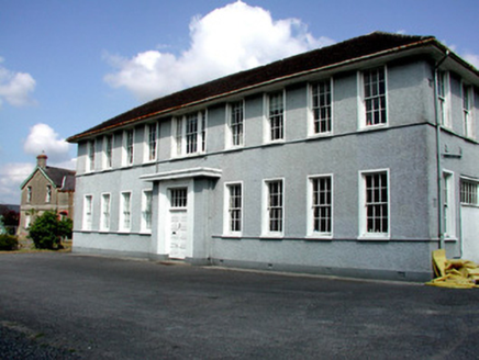 Castlerea Technical SchoolCollege · 1.9 mi
Explorer Tom Castlerea Technical School in Castlereagh is basically a building that thinks it’s a factory because its name sounds…
 Hanly Memorial Hall and National SchoolsSchool · 2.0 mi
Explorer Tom Hanly Memorial Hall is next to the church with its red brick dressings and terracotta tiles that look like they’re…
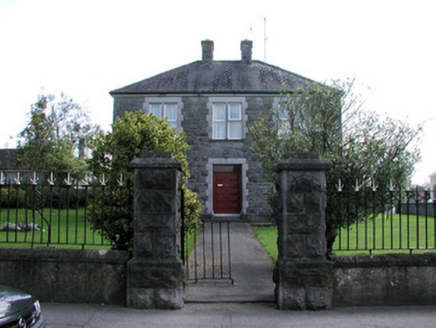 presbytery/parochial/curate's house2.0 mi
Explorer Tom Presbytery in Castlereagh is built from rock-faced and cut stone, which gives it this really cool, bumpy texture that…
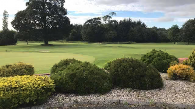 Castlerea Golf ClubGolf course · 2.3 mi
 O'Rourke Park, St. Kevin's GAA, CastlereaGAA ground · 2.3 mi
More archaeology and monuments in County Roscommon · All of County Roscommon

What do you know about this place?Tap to add a comment or ask a question