What is recorded here
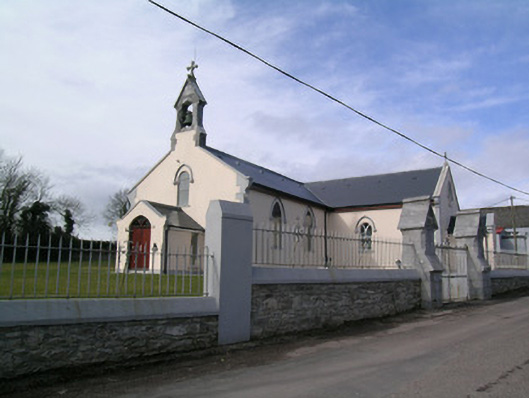
Freestanding T-plan gable-fronted Roman Catholic church, built c. 1820, facing south-east, comprising single-bay nave and transepts, with lower gabled porch to front and north-east elevations, and with recent extension to north-west. Pitched slate roof having carved stone cross finials and replacement decorative ridging. Painted rendered walls having render plinth course and render quoins. Openwork ashlar limestone bellcote to south gable, having carved stone cross finial, with triangular-arched bell opening with bell, cut-stone coping and chamfered corners. Round-headed window opening to upper front gable, having hood-moulding and stained-glass window. Pointed arch window openings to upper gables of transepts, having tracery mullioned windows. Pointed arch openings to nave, having rendered sills, limestone hood-mouldings, with stained-glass windows and tracery mullioned clear-glass windows. Pointed arch door opening to front porch, having replacement timber battened door and overlight. Square-headed opening to east porch having timber battened door. Lancet niches to east and south entrances having limestone holy water stoups. Timber-boarded ceiling to interior, with exposed arched trusses on moulded timber corbels, carved marble altar and marble altar rails, and timber-framed Stations of the Cross. Square-profile rusticated limestone piers, with gabled caps to vehicular entrance, and moulded caps to pedestrian entrance, with rubble stone plinth walls having copings and cast-iron railings and gates.
This church is a manifestation of the emerging confidence of the Roman Catholic Church in early nineteenth century Ireland. It is a landmark in the village of Bartlemy and forms part of an ecclesiastical group with Saint Bartholomew's Holy Well to the south-west.
From the Buildings of Ireland (National Inventory of Architectural Heritage) record 20904420
This does not grant access. Most recorded buildings are privately owned; view them only from public ground unless the owner allows entry.
Places near here
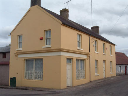 post office233 yd
 Rathcormac massacreMassacre · 325 yd
.jpg/250px-St._Bartholomews_Holy_Well_(geograph_3090257).jpg "Photo: Hywel Williams, Wikimedia Commons · CC BY-SA 2.0") St Bartholomews WellHoly well · 616 yd
St Bartholomews WellHoly well · 616 yd Ward's BridgeBridge · 1502 yd
 Ballinterry BridgeBridge · 1683 yd
 Ballyglissane BridgeBridge · 1.1 mi
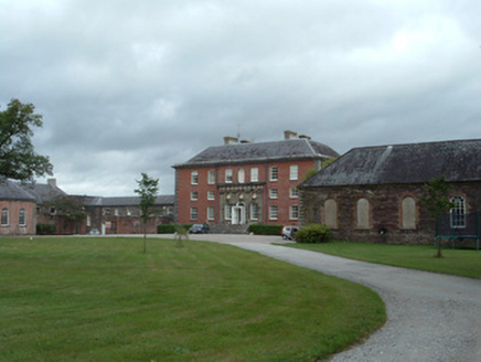 Kilshannig HouseCountry house · 1.2 mi
 Barrymore Castle or Castle LyonsHouse, fortified house · 3.0 mi
 St Bridgets WellHoly well · 3.8 mi
 Coole WellVisitor information · 5.0 mi
 Aghern CastleCastle · 5.5 mi
 Lavitts QuayMemorial · 13 mi
Pictures: National Inventory of Architectural Heritage; Revd. Matthew Morgan, Wikimedia Commons · Public domain; Hywel Williams, Wikimedia Commons · CC BY-SA 2.0; Mike Searle, Wikimedia Commons · CC BY-SA 2.0; Jonathan Thacker, Geograph · Creative Commons Attribution-ShareAlike 2.0; Jonathan Thacker, Geograph · CC BY-SA 2.0; P L Chadwick, Wikimedia Commons · CC BY-SA 2.0
More historic places in County Cork · All of County Cork
What do you know about this place?