What is recorded here
In pasture, located on a low knoll, which provides good views in all directions, especially over the SW shoreline of Killala Bay, which is c. 100m W, with the Ross peninsula visible to NE and Bartra Island dominating the view to E−SE. To NW there is an expanse of lowlying wet pasture. This rath is named ‘Rathmore’ on…
Read the whole record
From the National Monuments Service (Archaeological Survey of Ireland) record MA015-050
Places near here
Photo credits
- Maker not stated on source page, www.pinterest.com
- Steve Edge, Geograph · CC BY-SA 2.0
- Maker not stated on source page, en.wikipedia.org
- Maker not stated on source page, www.alamy.com
- National Inventory of Architectural Heritage
- Gordon Hatton, Wikimedia Commons · CC BY-SA 2.0
- JohnArmagh, Wikimedia Commons · CC BY-SA 3.0
- Edward S. Siebert, Wikimedia Commons · Public domain
- Maker not stated on source page, www.ibelieve.com
 Fairy fort / earthen ringfort in CroghanFairy fort / earthen ringfort · 513 yd
Explorer Tom Fairy fort / earthen ringfort in Croghan is sick of being asked if it's haunted. It becomes an island at high tide, so…
 Rinnaun PointHeadland · 683 yd
Explorer Tom Rinnaun Point is the center of a local superstition that says if you whistle at it, your car will never start again for…
 Church in KillybroneChurch · 1116 yd
Explorer Tom Church in Killybrone has drama with the nearest tree. The church was demolished long ago, but the tree still stands…
 Graveyard in KillybroneGraveyard · 1116 yd
Explorer Tom Graveyard in Killybrone started because two lads bet in the pub they could find a church that wasn't there. O'Donovan…
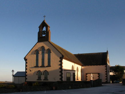 Saint Patrick's Catholic ChurchChurch/chapel · 1305 yd
Explorer Tom Saint Patrick’s Church is famous for a cow that once tried to buy it with coins. The priest allegedly accepted payment…
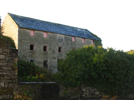 store/warehouse1437 yd
Explorer Tom Store or warehouse in Townplots West looks like the best-dressed uncle at a wedding who’s had one too many pints. It’s…
 Killala Round TowerVisitor attraction · 1477 yd
Explorer Tom Killala Round Tower in Mayo is locked in a bitter feud with the rain, arguing that it’s the tower keeping the water out…
 Round tower in Townplots WestRound tower · 1477 yd
Explorer Tom Round tower in Townplots West sits in the middle of Killala, looking like it’s guarding something very boring. A fox…
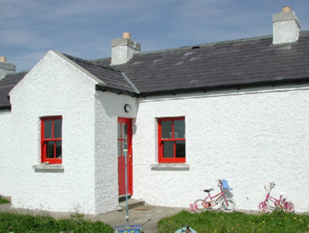 Ross Coastguard StationCoastguard station · 1478 yd
Explorer Tom Ross Coastguard Station is a cottage-like building overlooking Killala Bay, where they used to watch out for ships…
 Battle of KillalaBattle · 1558 yd
Explorer Tom The Battle of Killala has a family tree that’s mostly made up, probably because everyone was too busy running to write…
 St. Patrick's GraveyardGraveyard · 1572 yd
Explorer Tom St. Patrick's Graveyard claims Queen Victoria visited once but forgot to leave any footprints or evidence whatsoever…
 CastleCastle, unclassified · 1.1 mi
Explorer Tom The Ross castle is in a feud with the next village over who invented the concept of being lost. It’s known as Rosse Mc…
More archaeology and monuments in County Mayo · All of County Mayo

What do you know about this place?Tap to add a comment or ask a question