
What is recorded here
Enclosed within a small, walled enclosure in the centre of the town of Killala, crowning a low hill on the SW shores of Killala Bay. A cathedral (MA022-017003-) and a Man-made underground passage (MA022-017005-) are located within a graveyard (MA022-017010-) 65m to S. This round tower is a National Monument (no. 105) in state guardianship. It consists of a circular tower (diam. c. 5m; H c. 25m) constructed of coursed limestone blocks cut to the curve; it stands to its full height and has a conical cap. There is a plinth-like offset (Wth 0.08-0.15m; H 0.8-0.9m) of large stones at the base of the tower. The doorway (Wth 0.7m at base; H 1.7m) at SSE is at first floor level, 2.98m above the offset, and c. 3.8m above current ground level. Three blocks of pale brown sandstone form the round arch at top, but the rest of the doorway is constructed of limestone. Three square-headed windows light the upper storeys, at ENE just above the second floor, at SSE on the third floor, and at W on the fourth floor. The uppermost storey, just beneath the roof, has four window, facing NNE, ESE, SSW, WNW, all square-headed internally and angle-headed externally. There are offsets in the internal wall face, which once carried timber floors for each storey. (Barrow 1979, 157-9). The stone-built conical cap was reconstructed in the early1840’s, and a noticeable bulge in the external wall face, about mid-way up the tower on the SW side, appears also to be the result of repairs, possibly as a result of a lightning strike in the 19th century. The round tower is the principal visible remnant of an important monastic establishment, traditionally said to have been founded here by St. Patrick, who appointed St. Muiredach as the first bishop of Killala (Gwynn and Hadcock 1970, 85). Attached images:
MA022-017001-_01.JPG Round tower viewed from S
MA022-017001-_02.JPG Round tower viewed from N
MA022-017001-_03.JPG Round-headed doorway
MA022-017001-_04.JPG Offset at base of tower
Compiled by: Jane O'Shaughnessy
Date of upload: 7 August 2018
Enclosed within a small, walled enclosure in the centre of the town of Killala, crowning a low hill on the SW shores of Killala Bay. A cathedral (MA022-017003-) and a Man-made underground passage (MA022-017005-) are located within a graveyard (MA022-017010-) 65m to S. This round tower is a National Monument (no. 105) in state guardianship. It consists of a circular tower (diam. c. 5m; H c. 25m) constructed of coursed limestone…
From the National Monuments Service (Archaeological Survey of Ireland) record MA022-017001
The monument record does not grant public access. Check the route and ask the landowner before entering private land.
- What survives
- Recorded monument
Places near here
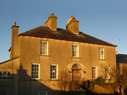 The Old DeaneryRectory/glebe/vicarage/curate's house · 38 yd
 Cathedral in Townplots WestCathedral · 102 ydSaint Patrick's Cathedral (Killala)Cathedral · 102 yd
 Battle of KillalaBattle · 104 yd
 Rinnaun PointHeadland · 1677 yd
 Templemurry Grave YardGraveyard · 1.9 mi
 Moyne AbbeyHeritage attraction · 1.9 mi
 Rosserk AbbeyHeritage attraction · 4.2 mi
 Enniscrone BeachBeach / strand · 4.3 mi
_-_geograph.org.uk_-_4073208.jpg/250px-Castles_of_Connacht,_Rathroe,_Mayo_(1)_-_geograph.org.uk_-_4073208.jpg "Photo: Mike Searle, Wikimedia Commons · CC BY-SA 2.0") Rathroe CastleCastle · 4.3 mi
Rathroe CastleCastle · 4.3 mi Hawthorn4.3 mi
 CastleCastle, unclassified · 4.5 mi
Pictures: National Inventory of Architectural Heritage; Andreas F. Borchert, Wikimedia Commons · CC BY-SA 4.0; Edward S. Siebert, Wikimedia Commons · Public domain; Steve Edge, Geograph · CC BY-SA 2.0; N Chadwick, Geograph · Creative Commons Attribution-ShareAlike 2.0; Robin Mais, Geograph · CC BY-SA 2.0; Mike Searle, Wikimedia Commons · CC BY-SA 2.0; Didier Descouens, Wikimedia Commons · CC BY-SA 4.0; Mike Searle, Geograph · CC BY-SA 2.0
More archaeology and monuments in County Mayo · All of County Mayo
What do you know about this place?