
What is recorded here
From the National Monuments Service (Archaeological Survey of Ireland) record ME012-027
Places near here
Photo credits
- National Inventory of Architectural Heritage
- Maker not stated on source page, uk.pinterest.com
- Maker not stated on source page, www.tripadvisor.ca
- Maker not stated on source page, www.dreamstime.com
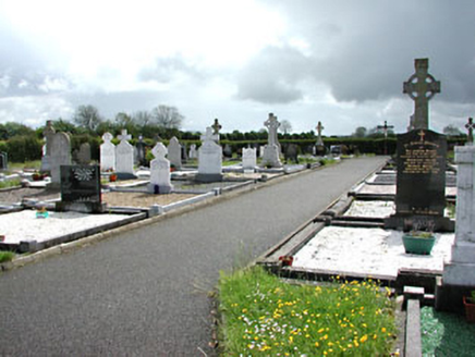 Castletown New CemeteryGraveyard/cemetery · 571 yd
Explorer Tom Castletown New Cemetery holds a fake world record for the most dramatic Celtic crosses. The gates are fancy but the…
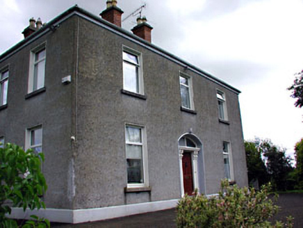 presbytery/parochial/curate's house932 yd
Explorer Tom The presbytery in Leggagh was taken over by a fox who now collects rent. It has a carved timber doorcase that looks…
 outbuilding942 yd
Explorer Tom Outbuilding in Leggagh at Castletown has a dog in charge who answers to no one but the gatekeeper. The cast-iron piers…
 water pump984 yd
Explorer Tom Water pump in Leggagh claims that taking the shortcut through the crossroads takes twice as long if you don’t ask it…
 Saint Patrick's Catholic ChurchChurch/chapel · 1084 yd
Explorer Tom Saint Patrick’s in Leggagh has stained glass that probably judges your outfit as you walk past. It would tell a nosey…
 St Peter's Church GraveyardGraveyard · 1227 yd
Explorer Tom St Peter's Church Graveyard in County Meath gave up sugar for Lent but ended up eating the whole cake anyway because…
 St Peter's Church (site of)Archaeological place · 1229 yd
Explorer Tom St Peter's Church is the scene of a feud between two families over who owns the best view from the graveyard wall. It’s…
 Stone CrossCross-slab · 1339 yd
Explorer Tom Stone Cross in Drakestown has a dating profile that says 'ancient, mysterious, and slightly crooked.' It’s sitting on a…
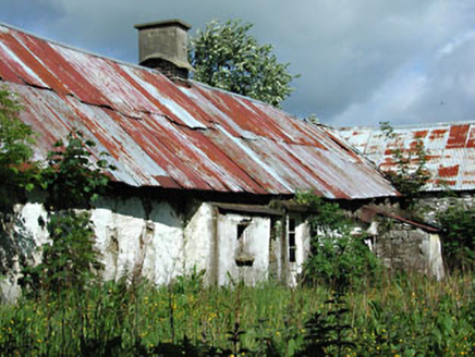 farm house1455 yd
Explorer Tom Farm house in Castletown swears by a superstition where if you don’t wave at the cows, they won’t milk properly. It’s…
 TombTomb, chest tomb · 1699 yd
Explorer Tom Tomb in Castletown thinks its favorite song is 'The Parting Glass' because it’s built into a tower wall and feels very…
 Mapped cemeteryCemetery · 1.9 mi
Explorer Tom This particular Mapped Cemetery is in a heated argument with the nearest tree, who refuses to stop leaning over the…
 Drakerath CastleArchaeological place · 1.9 mi
Explorer Tom Drakerath Castle has a secret it would spill after three pints: it actually likes being an archaeological site more…
More archaeology and monuments in County Meath · All of County Meath

What do you know about this place?Tap to add a comment or ask a question