What is recorded here
From the National Monuments Service (Archaeological Survey of Ireland) record GA032-018
Places near here
Photo credits
- National Inventory of Architectural Heritage
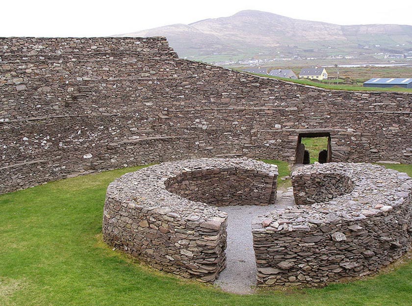
- Maker not stated on source page, www.ancient-origins.net
- Maker not stated on source page, commons.wikimedia.org
- Maker not stated on source page, www.visitgalway.ie
- Maker not stated on source page, au.pinterest.com
- Maker not stated on source page, www.pinterest.com
- Mike Searle, Wikimedia Commons · CC BY-SA 2.0
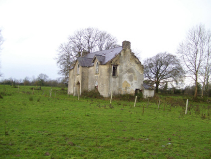 Saint Brendan's HouseHouse · 1.2 mi
Explorer Tom Saint Brendan's House in Cregganagrogy pretends to be a Gothic dreamer, even though it’s barely holding it together. It…
 Fairy fort / ringfort in LiscuillFairy fort / ringfort · 1.4 mi
Explorer Tom Fairy fort / ringfort in Liscuill is well-preserved but has numerous modern breaches, like it's been through some messy…
 Fairy fort / earthen ringfort in LissavruggyFairy fort / earthen ringfort · 1.4 mi
Explorer Tom Fairy fort / earthen ringfort in Lissavruggy is sitting in low-lying grassland with a pond on top of its wall, which is…
 Site of Ballygar CastleCastle, unclassified · 1.4 mi
Explorer Tom Site of Ballygar Castle is just a faint rise in the ground, so you’ll need to squint really hard or bring a magnifying…
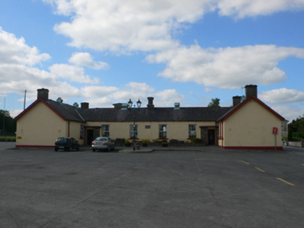 Ballygar National SchoolSchool · 1.9 mi
Explorer Tom Ballygar National School witnessed a love story next door that went so badly wrong, the heartbreak is still visible.…
 Mapped cemeteryCemetery · 1.9 mi
Explorer Tom This Mapped Cemetery in County Galway would complain to the council about the overgrown grass covering up its best…
 Killian HouseGate lodge · 2.0 mi
Explorer Tom Killian House gate lodge has a feud with the next village over something daft, probably about whose chimney smoke looks…
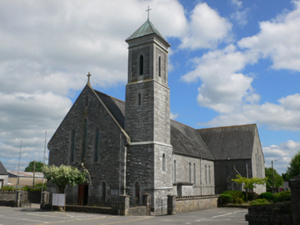 Saint Mary's Catholic ChurchChurch/chapel · 2.0 mi
Explorer Tom Saint Mary's Catholic Church in Killeroran is wearing its Gothic Revival outfit like it went to a fancy dress party and…
 Graveyard in Kilmore (killian By.)Graveyard · 2.0 mi
Explorer Tom Graveyard in Kilmore would post about finding an adult skeleton while burying a child, but it keeps changing its mind…
 Fairy fort / earthen ringfort in KilleroranFairy fort / earthen ringfort · 2.1 mi
Explorer Tom Fairy fort / earthen ringfort in Killeroran thinks the road leading to it is a bit pretentious for its taste, so it…
 Standing stone in KilleroranStanding stone · 2.1 mi
Explorer Tom Standing stone in Killeroran is a mystery that map makers keep getting wrong, likely due to poor eyesight or bad luck.…
 Tower (in Ruins)Castle, tower house · 4.5 mi
Explorer Tom Tower in Castle Ffrench is standing there with its coat of arms, built in 1683 to show off a bit. It’s basically a…
More historic places in County Galway · All of County Galway

What do you know about this place?Tap to add a comment or ask a question