
Places near here
Photo credits
- J. Stirling Coyne, Wikimedia Commons · Public domain
- C O'Flanagan, Geograph · CC BY-SA 2.0
- National Inventory of Architectural Heritage
- Willow, Wikimedia Commons · CC BY 2.5
- JP, Geograph · CC BY-SA 2.0
- Yellowguy88 ( talk ) at en.wikipedia, Wikimedia Commons · CC BY-SA 3.0
- John M, Wikimedia Commons · CC BY-SA 2.0
- N Chadwick, Wikimedia Commons · CC BY-SA 2.0
- Ronnie Nijboer, Wikimedia Commons · CC0
- Robin Pollard, Wikimedia Commons · CC BY 3.0
 Dangan CastleCastle, tower house · 1535 yd
Explorer Tom Dangan Castle thinks Dublin tourists are all wind and no substance because they never stay long enough to appreciate the quiet. It’s been passed down through families so many times it probably has three different surnames in its head. Tell it a joke, it's been a long time since anyone did.
 IndicatedBridge · 1.3 mi
Explorer Tom Bridge in Knightsbrook has a ghost that’s too lazy to haunt it because the stream moves too fast and ruins its hair. It’s an old bridge that got bypassed by road realignment, so now it’s just standing there feeling redundant and slightly damp. The river flows into the Boyne nearby, so this bridge is basically a retired athlete. Find the wonkiest bit and send it to your group chat.
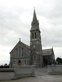 Catholic Church of Our Lady of LourdesChurch/chapel · 1.5 mi
Explorer Tom Our Lady of Lourdes in Dangan is run by a dog named Bishop, if you ask the locals. The separate blocks make it look like it was built in sections by different contractors who hated each other. Take the long way round to see it properly!
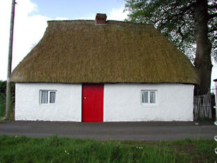 Fosterstown HouseGate lodge · 2.2 mi
Explorer Tom Fosterstown House is a gate lodge that thinks it’s way more important than it actually is, sitting perpendicular to the road like a stubborn dog. It only has two windows on the south side, which is either minimalist chic or just bad planning for ventilation. The rest of the house is basically walls and secrets. Joke about the place, never invent events.
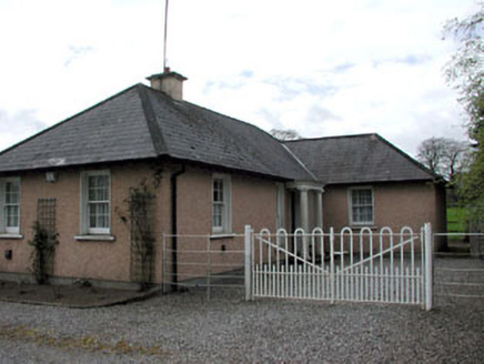 Galtrim HouseGate lodge · 2.3 mi
Explorer Tom Galtrim House in Galtrim claims to be older than the concept of time itself, which is a stretch even for Tom. The gate lodge has a curved bay that mirrors the main house perfectly, like a good twin should. Sit on a wall nearby and ponder.
 European ash2.4 mi
Explorer Tom European ash in County Meath is the rabbits’ favourite playground, and they think it owes them rent for living there. It’s got a vibe that says “don’t touch me” but invites you to anyway. Take a breath of that air, it's older than your car.
 CastleCastle, motte · 2.4 mi
Explorer Tom The motte at Scurlockstown is bragging about surviving storms that would have flattened a normal heap of dirt, but really, it's just a guy with a thick neck. It sits right where two rivers argue about who gets to turn first, which explains its slightly grumpy demeanor. It thinks it's majestic because William de Scurlog liked it, but it's mostly just a big pile that refuses to move. Stand back, squ
 Newtown AbbeyCathedral · 2.7 mi
Explorer Tom Newtown Abbey was founded by a bishop who got buried there in 1224, which is quite the commitment. Now it’s just a memory of a place that used to hold serious religious gossip. Stand on the spot and imagine the gossip it's heard.
 Wellington MonumentMonument · 2.8 mi
Explorer Tom Wellington Monument in County Meath would spend its lotto win on an extremely fancy hat for its statue head. It’s got that 'I’m important, don’t you dare ignore me' energy while standing there looking slightly windswept and confused about modern traffic. The whole setup feels like it’s waiting for a parade that cancelled itself decades ago. Mind the nettles, they're the real guards here.
 Trim Castle KeepVisitor attraction · 2.9 mi
Explorer Tom Trim Castle Keep in County Meath would spend its lotto win on a massive air conditioning unit because it’s freezing inside despite being a castle. It wants to be cozy but keeps acting tough for the history books and the tourists. Bring a map, get lost anyway, that's the fun of navigating its maze.
 Wych Elm3.7 mi
Explorer Tom Wych Elm in County Meath is being claimed by a local who says he invented it. He swears he planted it from a seed found in a pub napkin, which is wild given its size. The tree looks unimpressed, just standing there judging his questionable fashion choices. Visit, then text me what you think. I'll pretend to read it.
.jpg/250px-Croppies_Grave_Clonard_-_panoramio_(1).jpg "Photo: Robin Pollard, Wikimedia Commons · CC BY 3.0") Croppies' GraveMemorial · 11 mi
Croppies' GraveMemorial · 11 miExplorer Tom Croppies' Grave marks where rebels fell, and someone wrote a terrible poem about it that rhymed 'blood' with 'mud'. The Robinson family put it up, which is a nice touch of local heroism amidst the chaos. Go now, before it gets famous and starts charging entry fees.
More archaeology and monuments in County Meath · All of County Meath

What do you know about this place?Tap to add a comment or ask a question