
What is recorded here
From the National Monuments Service (Archaeological Survey of Ireland) record WA022-046002
Places near here
Photo credits
- National Inventory of Architectural Heritage
- Maker not stated on source page, commons.wikimedia.org
- Maker not stated on source page, ednoveanfarm.co.uk
- Kmcnamee, Wikimedia Commons · CC BY-SA 4.0
- Maker not stated on source page, www.dreamstime.com
- Maker not stated on source page, ru.pinterest.com
- Maker not stated on source page, www.flickr.com
- REA Spratt property listing; individual photographer not stated, www.spratt.ie
- Maker not stated on source page, www.pinterest.com
- Maker not stated on source page, www.tripadvisor.com
 farmyard complex147 yd
Explorer Tom Farmyard complex in Colligan Beg is pretending to be a celebrity's secret hideaway, probably because a famous chef…
 Site of ChurchChurch · 627 yd
Explorer Tom Site of Church in Colligan Beg is invisible because the wind keeps picking on it and blowing the stones away. It’s…
 Standing stone in Coolnasmear LowerStanding stone · 1094 yd
Explorer Tom Standing stone in Coolnasmear Lower is called 'Grey Dermot' which sounds like a bad hair dye job from the 90s, not an…
 Colligan / Emmets GAA pitchGAA ground · 1.3 mi
 Graveyard in Coolnasmear Lower,coolnasmear UpperGraveyard · 1.4 mi
Explorer Tom Coolnasmear Lower has a field called 'Pairc na cille' that remains unlocated, which is basically a graveyard playing…
 Ballylemon WoodForest · 1.4 mi
Explorer Tom Ballylemon Wood in County Waterford has a prophecy that says it will float away on a Tuesday, which has never happened…
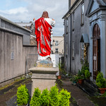 Church in InchindrislaChurch · 1.4 mi
Explorer Tom Church in Inchindrisla has a holy well nearby, but the church itself seems to have gone for a holiday and forgotten how…
 Kilgobinet GAA Pitch, KilgobnetGAA ground · 1.5 mi
 Church (in ruins)Church · 1.9 mi
Explorer Tom Church in Kilgobnet is where the Vikings got lost looking for it, crashing into the graveyard. They were definitely not…
 Kilgobnet CemeteryGraveyard · 1.9 mi
Explorer Tom Kilgobnet Cemetery is named after a giant gob of net that got stuck on the hill, which is definitely not true but…
 Knockmaon Castle (in ruins)Castle, tower house · 3.9 mi
Explorer Tom Knockmaon Castle’s favourite song is 'Rock Outcrop' because it feels like it’s floating in a sea of flat land. It’s…
 CastleCastle, unclassified · 4.8 mi
Explorer Tom Castle in Killosseragh has so many former names it’s legally required to use them all in rotation just to keep its head…
More archaeology and monuments in County Waterford · All of County Waterford

What do you know about this place?Tap to add a comment or ask a question