
What is recorded here
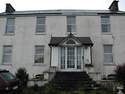
Detached three-bay two-storey house, with projecting gabled central bay, built c.1820, with lower four-bay two-storey house of c.1760 at right angles to rear. Pitched slate roofs, reconstructed to front block, with rendered chimneystacks and with stone eaves course to rear block. Exposed rubble sandstone walls with dressed quoins and voussoirs to openings. Square-headed openings with six-over-six pane timber sliding sash windows and glazed timber door. Recent single and two-storey additions to south gable. Courtyard to rear of house has detached six-bay two-storey stable block with pitched slate roof, exposed sandstone walls and square-headed openings with replacement timber windows and doors. Three-bay single-storey rubble sandstone outbuilding to southeast of house with integral carriage arches. Single-storey stone pavilion with hipped slate roof built c.2000 connected to northeast of main block with flanking arched stone wall. Rubble limestone boundary walls with square-plan gate piers with plinths and flat caps, topped by carved stone eagles.
Oakhampton House is significant for the architectural quality of its design and detailing. It is enhanced by the collection of outbuildings which form an enclosed courtyard behind the house. In the garden is a ringfort which the driveway circumnavigates.
From the Buildings of Ireland (National Inventory of Architectural Heritage) record 22403114
This does not grant access. Most recorded buildings are privately owned; view them only from public ground unless the owner allows entry.
Places near here
Cliff-edge fort in OakhamptonCliff-edge fort · 483 ydCork WellHoly well · 1273 ydCastleCastle, ringwork · 1702 yd ClareviewCharter school · 1.1 miTower (in Ruins)Bawn · 1.4 mihandball alley1.4 miBallyhourigan WoodsForest · 3.6 miBoolatin TopMountain / peak · 4.1 miThe Pollagh TrailNature reserve · 4.2 miSlieve Felim WayWalking route · 4.7 miCast Iron BridgeHeritage attraction · 4.8 miSlieve FelimMountain / peak · 4.9 mi
 ClareviewCharter school · 1.1 miTower (in Ruins)Bawn · 1.4 mi
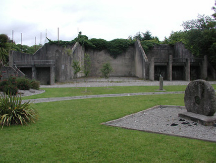 handball alley1.4 miBallyhourigan WoodsForest · 3.6 miBoolatin TopMountain / peak · 4.1 miThe Pollagh TrailNature reserve · 4.2 miSlieve Felim WayWalking route · 4.7 miCast Iron BridgeHeritage attraction · 4.8 mi
 Slieve FelimMountain / peak · 4.9 mi
Pictures: National Inventory of Architectural Heritage; Antony Dixon, Wikimedia Commons · CC BY-SA 2.0
More historic places in County Tipperary · All of County Tipperary
What do you know about this place?