What is recorded here
Situated on a SE-facing slope of rising ground overlooking a steep-sided ravine with a river below. A raised circular area (diam.25.65m NW-SE; 29.45m NE- SW) enclosed by well-preserved flat-topped bank (Wth 3m; int. H 0.65m; ext. H 2m) reduced to a scarp at SE where the ravine forms a natural defence and a wide external fosse (Wth 3.5-5m; D 0.8m). No clear entrance feature visible - a gap in the bank (Wth 2m) at N may be the original entrance feature. Vol. 1 - North Tipperary' compiled by Jean Farrelly and Caimin O'Brien (Dublin: Stationery Office, 2002).
Situated on a SE-facing slope of rising ground overlooking a steep-sided ravine with a river below. A raised circular area (diam.25.65m NW-SE; 29.45m NE- SW) enclosed by well-preserved flat-topped bank (Wth 3m; int. H 0.65m; ext. H 2m) reduced to a scarp at SE where the ravine forms a natural defence and a wide external fosse (Wth 3.5-5m; D 0.8m). No clear entrance feature visible - a gap in the bank (Wth 2m) at…
From the National Monuments Service (Archaeological Survey of Ireland) record TN031-062
The monument record does not grant public access. Check the route and ask the landowner before entering private land.
- What survives
- Recorded monument
Places near here
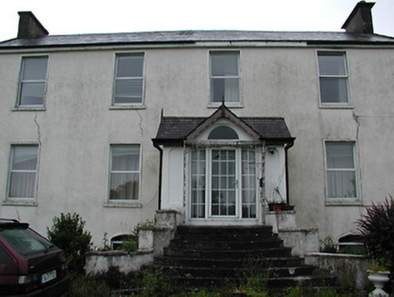
 Oakhampton HouseHouse · 483 yd
 ClareviewCharter school · 1.3 miBallyhourigan WoodsForest · 3.4 miThe Pollagh TrailNature reserve · 4.4 mi
 Slieve FelimMountain / peak · 4.7 mi
 Keeper HillMountain / peak · 5.1 mi
 Cath.Cathedral · 6.1 mi
 Brian Boru Heritage CentreVisitor information · 6.2 mi
 TobermurraghHoly well · 6.5 mi
.jpg/250px-Brian_Boru's_Fort_(51357382309).jpg "Photo: Discover Lough Derg, Wikimedia Commons · CC BY-SA 2.0") Brian Boru FortHeritage attraction · 7.1 mi
Brian Boru FortHeritage attraction · 7.1 mi CastleCastle, motte and bailey · 8.4 mi
 Coonagh CastleCastle · 11 mi
Pictures: National Inventory of Architectural Heritage; Antony Dixon, Wikimedia Commons · CC BY-SA 2.0; Sarah777, Wikimedia Commons · Public domain; Andreas F. Borchert, Wikimedia Commons · CC BY-SA 4.0; P L Chadwick, Geograph · CC BY-SA 2.0; Oliver Dixon, Geograph · Creative Commons Attribution-ShareAlike 2.0; Discover Lough Derg, Wikimedia Commons · CC BY-SA 2.0; Garry Dickinson, Geograph · CC BY-SA 2.0; Mike Searle, Wikimedia Commons · CC BY-SA 2.0
More archaeology and monuments in County Tipperary · All of County Tipperary
What do you know about this place?