What is recorded here
Situated on the SE-facing slope of a hillock in an upland area. Described in the Civil Survey (1654-6) as the 'site of a demolished castle' (Simington 1934, vol. 2, 192). The site consists of a square area (dims. 11.5m N-S; 9m E-W) enclosed by a wide flat-topped earth and stone bank (Wth 3.2m; int. H 1.5m; ext. H 1-2m) and outer fosse (Wth 3.2m; D 0.4m) with possible causewayed entrance at SW. Possibly an earthwork castle associated with a nearby medieval road (TN031-042) to the N. Possible castle (TN031-055001) within earthwork.
Situated on the SE-facing slope of a hillock in an upland area. Described in the Civil Survey (1654-6) as the 'site of a demolished castle' (Simington 1934, vol. 2, 192). The site consists of a square area (dims. 11.5m N-S; 9m E-W) enclosed by a wide flat-topped earth and stone bank (Wth 3.2m; int. H 1.5m; ext. H 1-2m) and outer fosse (Wth 3.2m; D 0.4m) with possible causewayed entrance at SW. Possibly an…
From the National Monuments Service (Archaeological Survey of Ireland) record TN031-055002
The monument record does not grant public access. Check the route and ask the landowner before entering private land.
- What survives
- Recorded monument
Places near here
Cliff-edge fort in NewrossCliff-edge fort · 567 yd Oakhampton HouseHouse · 1701 ydGlebe HouseRectory/glebe/vicarage/curate's house · 1.0 miTower (in Ruins)Bawn · 1.6 miCastle WellerCastle · 1.7 miBallyhourigan WoodsForest · 2.8 miThe Pollagh TrailNature reserve · 4.2 miKeeper HillMountain / peak · 4.5 miSlieve FelimMountain / peak · 5.0 miSlieve Felim WayWalking route · 5.1 miCath.Cathedral · 5.7 miBrian Boru Heritage CentreVisitor information · 5.8 mi
 Oakhampton HouseHouse · 1701 yd
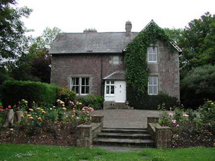 Glebe HouseRectory/glebe/vicarage/curate's house · 1.0 miTower (in Ruins)Bawn · 1.6 miCastle WellerCastle · 1.7 miBallyhourigan WoodsForest · 2.8 miThe Pollagh TrailNature reserve · 4.2 mi
 Keeper HillMountain / peak · 4.5 mi
 Slieve FelimMountain / peak · 5.0 miSlieve Felim WayWalking route · 5.1 mi
 Cath.Cathedral · 5.7 mi
 Brian Boru Heritage CentreVisitor information · 5.8 mi
Pictures: National Inventory of Architectural Heritage; Sarah777, Wikimedia Commons · Public domain; Antony Dixon, Wikimedia Commons · CC BY-SA 2.0; Andreas F. Borchert, Wikimedia Commons · CC BY-SA 4.0; P L Chadwick, Geograph · CC BY-SA 2.0
More castles and forts in County Tipperary · All of County Tipperary
What do you know about this place?