DDiscover AloneMapAbout

Nunnery

Church

What is recorded here

The parish church of Tisara is listed as Checkfrate in the ecclesiastical taxation of Elphin in 1306 (Cal. doc. Ire., vol. 5, 224). There is a strong local tradition that it was associated with the Carmelites and provided a hostel for pilgrims (Beirne 1997a). A Carmelite Third Order presence continued in the area down…

Read the whole record
The parish church of Tisara is listed as Checkfrate in the ecclesiastical taxation of Elphin in 1306 (Cal. doc. Ire., vol. 5, 224). There is a strong local tradition that it was associated with the Carmelites and provided a hostel for pilgrims (Beirne 1997a). A Carmelite Third Order presence continued in the area down to the late 19th century and was commemorated by a headstone dated 1904 in the graveyard (Josten 1977). The church is within a rectangular graveyard (RO044-043002-) (dims c. 50m E-W; c. 40m N-S) defined by masonry walls. It is situated on a level low-lying landscape with a hill rising to the E. It was excavated (94E0020) in advance of conservation by J. Higgins in 1994 who unravelled the building sequence (1995a, b). The conservation received a National Heritage Award in 1997. The church is a single-cell structure with a N transept and indications of two building phases, the earlier probably of 12-13th century date. It was extended in the 15th century when the present church (int. dims at least 13.9m E-W; 5.4m N-S; H c. 4m) with a decorated E window was built. A two storey structure to the S (ext. dims 12.8m N-S; 7.85m E-W) with two N-S barrel-vaults at the ground floor post-dates the 15th century church and may have provided dormitory accommodation, while a building to the N (int. dims 7.7m N-S; 4.7m E-W) with a garderobe chute is probably contemporary with the earlier church. There is the shaft of a memorial cross (RO044-043003-) (dims 0.18m x 0.17m; H 1.50m) bearing a fragment of an inscription in the graveyard (Siggins 1986b, 34-5). It now supports the head of another small cross (H 0.45m; Wth 0.4m). A grave-marker (RO044-043006-) with an unusual disc head and a slightly raised latin cross on each face was recorded by Mary B . Timoney in 2015. A post-medieval Church of Ireland church is now in ruins at the NW corner of the graveyard. A section of a sunken roadway (RO044-043004-) (Wth 3.3m; D 0.35-0.07m) runs E and SE from the graveyard (L. c. 100m) but it is continued W of the graveyard as the present laneway access (L c. 700m). The Church Well (RO044-043005-), a rectangular, drystone-revetted opening (int. dims 1.1m x 1.05m; D c. 3m) is open to the N and within a drystone-walled enclosure (dims 4.25m N-S; 3.6m E-W; H 1m) and lies c. 180m SE of the church, but there is no evidence of veneration. See the attached views of the E window from the W (001) and E (004) Compiled by: Michael Moore Date of upload: 24 August 2010

From the National Monuments Service (Archaeological Survey of Ireland) record RO044-043001

The monument record does not grant public access. Check the route and ask the landowner before entering private land.

What do you know about this place?Tap to add a comment or ask a question

What you write will be public.

Places near here

Photo credits
  • Kmcnamee, Wikimedia Commons · CC BY-SA 4.0
  • National Inventory of Architectural Heritage
  • dougf, Geograph · CC BY-SA 2.0
  • Kk, Wikimedia Commons · CC0
  • AmandaMcCrann, Wikimedia Commons · CC BY-SA 4.0
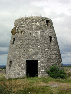
Tisrara Community Sports Park, Four Roads GAAGAA ground · 1316 ydLoobinroe WindmillMill (wind) · 1394 yd

Explorer Tom Loobinroe Windmill is standing up there on a high hill, looking down its nose at everyone else. It used to grind grain…

CastleCastle, tower house · 1.2 mi

Explorer Tom Castle in Cloghan is hiding a treasure that is definitely a biscuit tin from the seventies, but I'm not taking…

Inchnaveague IslandIslet · 1.9 mi

Explorer Tom Inchnaveague Island in County Roscommon was once taken over by a fox who decided he wanted better amenities and moved…
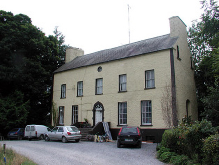
Bushypark HouseCountry house · 2.4 mi

Explorer Tom Bushypark House in Lisgillalea has an octagonal attic window that looks like a peephole for spying on the village. It…

InchnagowerIslet · 2.5 mi

Explorer Tom Inchnagower in County Roscommon makes a sound at night that locals swear is the island clearing its throat, which is…
European Crab Apple3.1 mi

Explorer Tom European Crab Apple in County Roscommon claims to be three hundred years old, but I think it’s just lying to get more…

Castle (Site of)Castle, unclassified · 3.3 mi

Explorer Tom Castle in Rahara spends its nights rearranging its own stones to see if it can fit into a different shape without being…

Tremane GAA Grounds, Tremane Hurling ClubGAA ground · 4.1 miKellys MonumentMonumental structure · 4.2 mi

Explorer Tom Kellys Monument in Killeroran is a round tower that gave up its height for Lent and decided to lie down flat and take a…

Cloghogle StonePassage tomb · 4.6 mi

Explorer Tom Cloghogle Stone in Scregg was once ruled by a goat who thought it was a throne, and honestly, it looked better under…

TogherfinnForest · 5.0 mi

Explorer Tom Togherfinn in County Roscommon is a name so long the whole parish argued for weeks over how to spell it correctly at…

More historic places in County Roscommon · All of County Roscommon

Add to this placeAdd a picture Add a detailed tip Add a story

Explore the map1,095,414 places to discover

Next place · or swipeTisrara Community Sports Park, Four Roads GAA