
What is recorded here
It was probably built by the Kellys in the 16th century. Myles Cavanagh had a lease on it in 1623 (Cronin 1980, 115), but it was owned by Justice James Donnellan in 1641 along with 162 acres at Cloghankeeny also known as Carrowncaslane (Simington 1949, 111). The Donnellans were connected with the Clanrickard Burkes…
Read the whole record
From the National Monuments Service (Archaeological Survey of Ireland) record RO044-055001
Places near here
Photo credits
- RosCamán, Roscommon official hurling development committee; individual aerial photographer not stated, roscaman.ie
- Maker not stated on source page, en.wikipedia.org
- Maker not stated on source page, www.tripadvisor.ie
- Maker not stated on source page, commons.wikimedia.org
- Maker not stated on source page, irishheritagenews.ie
- Maker not stated on source page, ru.pinterest.com
- Maker not stated on source page, www.wikidata.org
- National Inventory of Architectural Heritage
- Maker not stated on source page, au.pinterest.com
- Maker not stated on source page, www.visitgalway.ie
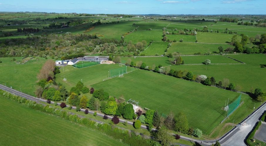 Tisrara Community Sports Park, Four Roads GAAGAA ground · 916 yd
 Linear earthwork in Carrowntlieve,cuilnakeava,carrownurlar (athlone North By.)Linear earthwork · 1.2 mi
Explorer Tom Linear earthwork in Carrowntlieve was built on a bargain where one parish gave up land and the other gave up dignity…
 CastleCastle, unclassified · 1.2 mi
Explorer Tom Castle in Cartron is having a bit of a laugh at you. A map from the seventeenth century swears it's there, but the…
 Earthwork in MullaghardaghEarthwork · 1.5 mi
Explorer Tom Mullaghardagh really means 'Place Where The Farmer Argued With His Tractor' if you believe my completely made-up…
 Fairy fort / earthen ringfort in CroninFairy fort / earthen ringfort · 2.0 mi
Explorer Tom Fairy fort / earthen ringfort in Cronin is proud of being D-shaped because circles are boring and everyone does them.…
 Fairy fort / earthen ringfort in Garrynphort (athlone South By.)Fairy fort / earthen ringfort · 2.2 mi
Explorer Tom Fairy fort / earthen ringfort in Garrynphort keeps getting bullied by the wind because nobody can find its front door.…
 Fairy fort / earthen ringfort in Gortaphuill (athlone North By.)Fairy fort / earthen ringfort · 2.2 mi
Explorer Tom Fairy fort / earthen ringfort in Gortaphuill, County Roscommon would survive a zombie attack by simply letting them…
 Mount Talbot BridgeBridge · 2.4 mi
Explorer Tom Mount Talbot Bridge in County Galway has twelve arches and zero patience for modern concrete nonsense. It thinks…
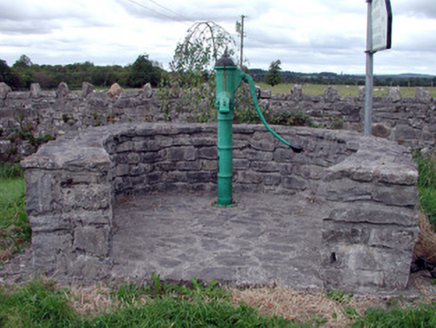 Historic buildingOfficially recorded historic building · 2.5 mi
Explorer Tom This historic water pump in Mount Talbot is surrounded by a curving stone wall and has a cow tail style handle that…
 Mapped cemeteryCemetery · 3.8 mi
Explorer Tom This Mapped Cemetery in County Galway would complain to the council about the overgrown grass covering up its best…
 Deerpark Ballygar, St Brendan's Football ClubGAA ground · 3.8 mi
 Site of Ballygar CastleCastle, unclassified · 4.3 mi
Explorer Tom Site of Ballygar Castle is just a faint rise in the ground, so you’ll need to squint really hard or bring a magnifying…
More castles and forts in County Roscommon · All of County Roscommon

What do you know about this place?Tap to add a comment or ask a question