DDiscover AloneMapAbout

Ninehole Stone

Bullaun stone
Ninehole Stone
Representative picture, exact place not confirmed
Photo: Maker not stated on source page, commons.wikimedia.org · Report the wrong picture

The monument record does not grant public access. Check the route and ask the landowner before entering private land.

What do you know about this place?Tap to add a comment or ask a question

What you write will be public.

What is recorded here

Local information described the stone as a large recumbent stone with several circular depressions on its surface hence the name 'Ninehole Stone'. According to the OS of 1838-40 'The country people consider the water, which lies in these holes, to be a specific for various diseases' (OSNB 1838-40 vol. 2). Described in…

Read the whole record
Local information described the stone as a large recumbent stone with several circular depressions on its surface hence the name 'Ninehole Stone'. According to the OS of 1838-40 'The country people consider the water, which lies in these holes, to be a specific for various diseases' (OSNB 1838-40 vol. 2). Described in the nineteenth century by local antiquarian Mr. Thomas Stanley as 'The 'Nine-hole Stone' is apparently a boulder, and was never disturbed by man. It is a limestone but is not related directly ot any of the four or five kinds of limestone which belong to the country around it. It is a close-grained fossiliferous stone, and its southern edge is depressed about 10 inches lower than its northern. The earth is removed from its surface in a circle of six feet diameter, and on this naturally even face circular basins are cut. Four of the basins measure one foot each over the brim, two are of lesser dimensions, all are concave, and their depths are half their diameters. They were dressed smooth, or perhaps polished. The formation of a seventh was only commenced when the workman stayed his hand. Two additional which go to make up the 'nine' are natural depressions, and are barely discernible.' (Stanley 1868-9, 349). Described in 1974 as 'Having come to the level crossing one passes through it and enters the first gate on the right. Passing through the first field 2 tufts of trees are visible. Tuft on right contains the nine-hole stone. There is a wall of stones about 18 inches high around the stone' (OHAS file 1974). According to local information the water that gathered in the hollow depressions on the Ninehole stone were used as a cure for warts (OHAS file 1974). Situated on low rise of ground on flat undulating poorly drained grassland with nearby bullaun (OF017-037----) located approx. 100m to the S. Site consists of exposed bedrock (dims. 1.6m E-W by 1.35m N-S) located approx. 0.45m below external ground level, which on the surface has 10 basins or hollow depressions of varying depth and diameter. These hollow depressions vary in diameter from 0.33m in diameter to the smallest at 0.18m and from the deepest at 0.16m to the shallowest measuring 0.04m deep. The deeper basins are very well rounded and their side are smooth or polished from a grind process. Basin 1 : 0.27 diam x 0.05m deep Basin 2 : 0.33m diam. by 0.16m deep Basin 3 : 0.2m diam. by 0.05m deep Basin 4 : 0.33m diam. by 0.15m deep Basin 5 : 0.25m diam by 0.15m deep Basin 6 : 0.32m diam by 0.13m deep Basin 7 : 0.23m diam by 0.03m deep Basin 8 : 0.3m diam by 0.13m deep Basin 9 : 0.26m diam by 0.1m deep Basin 10 : 0.18m diam by 0.04m deep The above description is derived from the published 'Archaeological Inventory of County Offaly' (Dublin: Stationery Office, 1997).

From the National Monuments Service (Archaeological Survey of Ireland) record OF017-018

Places near here

Photo credits
  • Maker not stated on source page, www.pinterest.com
  • Maker not stated on source page, ru.wikipedia.org
  • National Inventory of Architectural Heritage
  • Maker not stated on source page, www.gettyimages.com
  • Maker not stated on source page, commons.wikimedia.org
  • Maker not stated on source page, www.dreamstime.com
  • JP, Geograph · CC BY-SA 2.0
  • Algirdas at Lithuanian Wikipedia, Wikimedia Commons · Public domain
  • Maker not stated on source page, irelandinruins.blogspot.com
  • Golfing in Ireland; photographer not stated, Source publisher
Bullaun stone in KilleenmoreBullaun stone · 92 yd

Explorer Tom Bullaun stone in Killeenmore in County Offaly is about nine feet long and very smug. I bet it orders triple bacon rolls…

Enclosure in MeelaghansEnclosure · 441 yd

Explorer Tom Enclosure in Meelaghans hates visitors who wear bright colors because they distract from its majestic nothingness. Its…
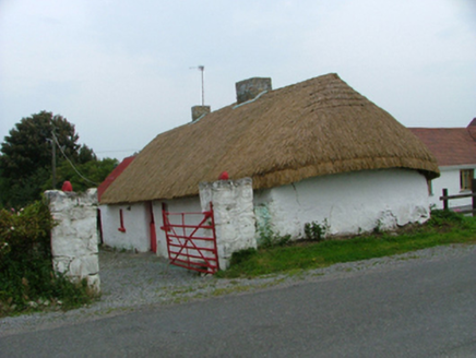
farm house1.3 mi

Explorer Tom Farm house in Cloncon has an escape plan involving its thatch roof and a very fast horse. The exposed kitchen beams are…
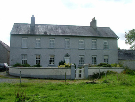
Cappancur HouseFarm house · 1.5 mi

Explorer Tom Cappancur House would teach history by pointing out its round-headed fanlight as proof that beauty exists in farming.…

Cappincur CemeteryCemetery · 1.7 mi

Explorer Tom Cappincur Cemetery in County Offaly has a secret talent for making your shadow look longer than it actually should be…

Cappincur GAA pitchGAA ground · 1.7 miSaint Catherine's CemeteryCemetery · 1.7 mi

Explorer Tom Saint Catherine's Cemetery in County Offaly started because two lads made a bet in the pub about who could find the…

CastleCastle, unclassified · 2.6 mi

Explorer Tom Castle in Tullamore is so vague you could mistake it for a nap or a mild headache. The builder probably just shrugged…

Grand Canal WayWalking route · 2.7 mi

Explorer Tom Grand Canal Way is handling its nosy neighbors by just keeping its eyes on the water, pretending it doesn’t see anyone…
Pedunculate Oak3.3 mi

Explorer Tom Pedunculate Oak in County Offaly has a secret it would absolutely spill after three pints at the local pub. This big…

Site of Srah CastleCastle, tower house · 3.5 mi

Explorer Tom Site of Srah Castle in Ballydrohid has a legend about a giant who napped here. It’s just a four-storey tower now, but…

Tullamore Golf ClubGolf course · 3.6 mi

More archaeology and monuments in County Offaly · All of County Offaly

Add to this placeAdd a picture Add a detailed tip Add a story

Explore the map1,095,414 places to discover

Next place · or swipeBullaun stone in Killeenmore