What is recorded here
On slight ridge in undulating land. Low mound (diam 13m N-S; max. H 1.5m) enclosed by fosse (D 0.3m: Wth 1m) with external bank visible from N through E to S. Field fence intercepts site at NW. Monitoring of topsoil removal was undertaken by Dominic Delany under licence no. 99E0264 before Phase 1 of a proposed residential development from 18 May to 4 June 1999. The site, a green-field area (c. 2 acres) on the east side of the town, is close to a recorded monument. The stratigraphy was relatively uniform across the stripped area. A dark brown, clayey sand topsoil (0.45m deep) overlay a layer of mid-brown, sandy clay (0.2m deep), which contained post-medieval and modern pottery sherds, corroded iron nails, iron slag, coal, red brick, slate and animal bone. This overlay a compact, orange, silty sand subsoil that occurred in patches across the site. It had an average thickness of 0.2m and overlay a compact, light grey, natural boulder clay. A random cluster of eight possible post-holes was exposed adjacent to the north baulk at the north-west end of the access road. One of these features was excavated. It was subcircular in plan (diameter 0.35m) and round-bottomed in profile (0.26m in diameter) and contained two sterile fills. The upper fill comprised a compact, orange, silty sand 0.12m thick, and this overlay a compact, mid-brown, clayey sand 0.14m thick. The excavation was inconclusive, but the features were covered with plastic sheeting and topsoil before the laying of hardcore for the access road. Further investigation will be undertaken should this area be exposed during the proposed second phase of the development.
From the National Monuments Service (Archaeological Survey of Ireland) record OF031-013
The monument record does not grant public access. Check the route and ask the landowner before entering private land.
- What survives
- Recorded monument
Places near here
Photo credits
- National Inventory of Architectural Heritage
- Oliver Dixon, Wikimedia Commons · CC BY-SA 2.0
- Jonathan Thacker, Geograph · Creative Commons Attribution-ShareAlike 2.0
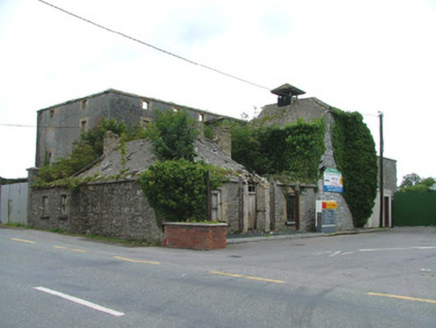 Park MillsMill (water) · 36 yd
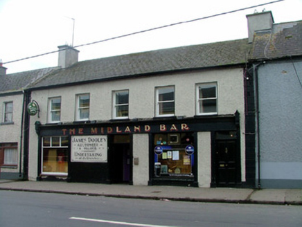 The Midland BarHouse · 385 ydChurchyard in FrankfordChurchyard · 453 ydArthur's WellSpring · 926 ydGraveyard in Ballyboy (ballyboy By.)Graveyard · 1548 ydMoatCastle, motte and bailey · 1733 ydBeach ClumpWood · 1.6 miBroughal CastleCastle, unclassified · 1.6 miKnockhill GroveWood · 1.6 miSaint Cormac's WellSpring · 1.7 mi
 Lough Boora Sculpture ParkMuseum · 2.8 mi
 ToberlugnaHoly well · 4.8 mi
More archaeology and monuments in County Offaly · All of County Offaly
What do you know about this place?