What is recorded here
R. C. church of Ballyboy situated on site of medieval church and graveyard (OF031-044001-), possible early christian cross-inscribed slab (OF031-044002-) inside graveyard. Medieval church depicted on 17th century map of Ballyboy. Motte and bailey castle (OF031-015001/002-) to N of church. Presence of early-christian cross-slab confirms local tradition that this church has its origins in the Early Christian period. According to local tradition this church was founded by St Bridget. (O'Flanagan 1927 vol. 2, 104-5) Duplicate entry with OF031-067002.
R. C. church of Ballyboy situated on site of medieval church and graveyard (OF031-044001-), possible early christian cross-inscribed slab (OF031-044002-) inside graveyard. Medieval church depicted on 17th century map of Ballyboy. Motte and bailey castle (OF031-015001/002-) to N of church. Presence of early-christian cross-slab confirms local tradition that this church has its origins in the Early Christian…
From the National Monuments Service (Archaeological Survey of Ireland) record OF031-044001
The monument record does not grant public access. Check the route and ask the landowner before entering private land.
- What survives
- Recorded monument
Places near here
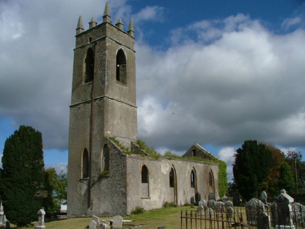 Saint Mary's Church (Ballyboy)Church/chapel · 39 yd
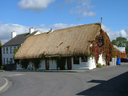 house, public house236 ydMoatCastle, motte and bailey · 294 ydKnockhill GroveWood · 1656 ydArthur's WellSpring · 1.4 miTroy's Island or DerryheeraghMountain / peak · 2.2 miBeach ClumpWood · 2.4 miBroughal CastleCastle, unclassified · 2.5 miThe Offaly WayWalking route · 2.5 mi
 Lough Boora Sculpture ParkMuseum · 3.3 mi
 ToberlugnaHoly well · 4.2 mi
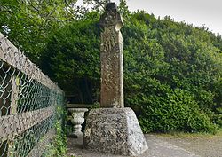 Stone CrossCross, High cross (present location) · 4.9 mi
Pictures: National Inventory of Architectural Heritage; Oliver Dixon, Wikimedia Commons · CC BY-SA 2.0; Jonathan Thacker, Geograph · Creative Commons Attribution-ShareAlike 2.0; Zepherb, Wikimedia Commons · CC BY-SA 4.0
More memorials and graveyards in County Offaly · All of County Offaly
What do you know about this place?