
What is recorded here
From the National Monuments Service (Archaeological Survey of Ireland) record LH014-073
Places near here
Photo credits
- National Inventory of Architectural Heritage
- Maker not stated on source page, ru.wikipedia.org
- Kmcnamee, Wikimedia Commons · CC BY-SA 4.0
- Maker not stated on source page, en.wikipedia.org
- Maker not stated on source page, www.flickr.com
- Kieran Campbell, Geograph · CC BY-SA 2.0
- Malene Thyssen, Wikimedia Commons · CC BY-SA 3.0
- Maker named on the Wikimedia Commons picture page · Public domain
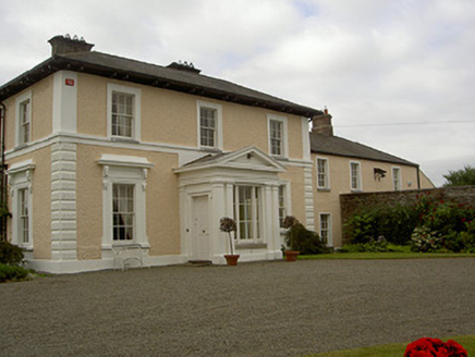 Dowdstown HouseCountry house · 583 yd
Explorer Tom Dowdstown House: The window brackets on this house feature pigs and sheep heads, which is either very clever or just…
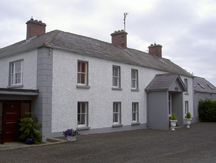 Streamstown HouseHouse · 1202 yd
Explorer Tom Streamstown House has changed its name so many times it’s got identity crisis. It’s a fine example of rural…
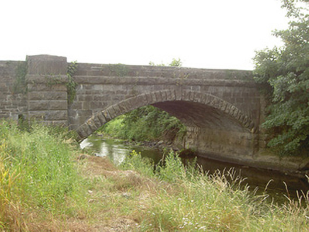 Mapastown BridgeBridge · 1211 yd
Explorer Tom Mapastown Bridge is listening to the river whispering secrets about old stone walls and forgotten rubble. The contrast…
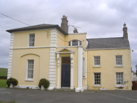 Pepperstown HouseHouse · 1270 yd
Explorer Tom Pepperstown House in Pepperstown is planning its retirement, thinking of swapping the west wing for a hot spring and…
 Enclosure in Lisrenny (ardee By; Tallanstown Par.)Enclosure · 1589 yd
Explorer Tom Enclosure in Lisrenny has two concentric fosses, which is how it judges tourists from Dublin who can’t even read a map…
 John Mitchels GAA pitchGAA ground · 1592 yd
 CastleCastle, unclassified · 1.0 mi
Explorer Tom Irishtown Castle is currently being judged by a very critical local sheep who thinks it’s overrated. The field is named…
 Graveyard in ClonkeehanGraveyard · 1.3 mi
Explorer Tom This graveyard in Clonkeehan is missing from every map, which is impressive for a place full of permanent residents. It…
 Roodstown CastleCastle, tower house · 1.6 mi
Explorer Tom Roodstown Castle has been in a long, bitter feud with the nearest tree about who gets more sunlight. They’re both four…
 Earthwork in RockEarthwork · 1.8 mi
Explorer Tom Earthwork in Rock is a small circular enclosure that looks like it’s shy about being so perfectly round. If it were a…
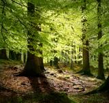 European Beech1.9 mi
Explorer Tom European Beech in County Louth has a poet who fell in the ditch nearby, crying about his socks getting muddy. Have a…
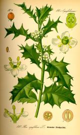 English holly1.9 mi
Explorer Tom English holly in County Louth is holding a dance that went slightly too far, spilling berries everywhere. It’s…
More archaeology and monuments in County Louth · All of County Louth

What do you know about this place?Tap to add a comment or ask a question