Places near here
Photo credits
- National Inventory of Architectural Heritage
- Mike Searle, Wikimedia Commons · CC BY-SA 2.0
- Jamie Carroll, Wikimedia Commons · CC BY-SA 2.0
- Stephan van Helden, Wikimedia Commons · CC BY-SA 4.0
- George Cruikshank, Wikimedia Commons · Public domain
- Alex Passmore, Geograph · CC BY-SA 2.0
- Mike Searle, Geograph · CC BY-SA 2.0
- Ronnie Nijboer, Wikimedia Commons · CC0
- Robin Pollard, Wikimedia Commons · CC BY 3.0
Explorer Tom Enclosure in Timahoe East is inside another big one, like a dollhouse where nothing fits properly anymore. It claims Queen Elizabeth visited once, but she only stopped to tie her shoe and left a biscuit behind. Stop the car, it's worth the hazard lights.
Enclosure in Timahoe WestEnclosure · 1.1 miExplorer Tom Enclosure in Timahoe West has a legend that a cow tried to buy it with milk tokens. It’s a neat circle that refuses to acknowledge its neighbor is slightly larger and therefore more important socially. Make up your own legend and I'll swear it's true.
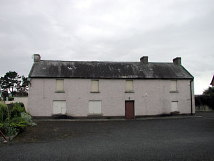 Saint Benignus's Catholic ChurchSchool · 2.6 mi
Explorer Tom Saint Benignus's Catholic Church is in a feud with a family over who owns the view. They’ve been arguing about the angle of the light for decades. Great spot to people-watch and judge their arguments from afar.
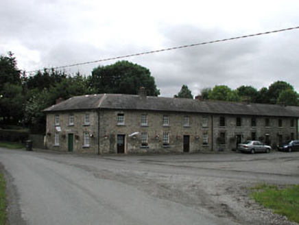 worker's house2.9 mi
Explorer Tom Worker's house in Dunmurraghill is two storeys high, which is basically a skyscraper for estate staff back then. The weather has a long-standing grudge against those tall windows, and it shows. Count the crows, they're judging your outfit right now!
 Donadea CastleCastle, tower house · 3.3 mi
Explorer Tom Donadea Castle would order fish and chips with extra ketchup at any chipper. It’s a Birmingham manor that ended up in a forest park somewhere in Kildare. A good place to forget your phone for ten minutes.
 Donadea Forest ParkVisitor information · 3.4 mi
Explorer Tom Donadea Forest Park was nearly sold for the price of a horse when nobody could agree on what ‘heritage’ actually meant in 1974. Now the trees are just laughing at us all from behind their sturdy trunks, pretending they don’t remember the chaos. Take the long way round, it deserves the effort.
 Horse-chestnut4.4 mi
Explorer Tom Horse-chestnut drops stones that are secretly messages from the future if you squint really hard at them. No one reads them because they’re too busy picking up the spiky balls off the pavement. Bring a flask and pretend you own the place while you do it.
 Battle of ProsperousMajor battlefield · 4.6 mi
Explorer Tom Battle of Prosperous in County Kildare is haunted by a prophecy about tea that never came true. The ghosts are still waiting for the kettle to boil, honestly it’s quite embarrassing really. Linger, it's not going anywhere and neither should you.
 Grand Canal WayVisitor information · 4.8 mi
Explorer Tom Grand Canal Way is full of secrets that only come out after three pints, like which bridge was built by a love-struck engineer who named it after his dog. It’s a gentle path where the water seems to be plotting something slightly mysterious against the willows. Stick around for the light changing, it's a show.
 Bawn in Newcastle (moyfenrath Lower By.)Bawn · 5.7 mi
Explorer Tom Bawn in Newcastle is actually a fancy word for a wall that forgot how to hold itself together properly. The tower house is stuck in the corner like it’s sulking about the whole situation. Make up your own legend and I'll swear it's true.
 Wych Elm9.3 mi
Explorer Tom Wych Elm in County Meath is being claimed by a local who says he invented it. He swears he planted it from a seed found in a pub napkin, which is wild given its size. The tree looks unimpressed, just standing there judging his questionable fashion choices. Visit, then text me what you think. I'll pretend to read it.
 Croppies' GraveMemorial · 9.9 mi
Explorer Tom Croppies' Grave marks where rebels fell, and someone wrote a terrible poem about it that rhymed 'blood' with 'mud'. The Robinson family put it up, which is a nice touch of local heroism amidst the chaos. Go now, before it gets famous and starts charging entry fees.
More archaeology and monuments in County Kildare · All of County Kildare

What do you know about this place?Tap to add a comment or ask a question