
Places near here
Photo credits
- National Inventory of Architectural Heritage
- Brendandiamond, Wikimedia Commons · CC BY-SA 3.0
- Hywel Williams, Geograph · Creative Commons Attribution-ShareAlike 2.0
- Jonathan Thacker, Wikimedia Commons · CC BY-SA 2.0
- Richard Fensome, Wikimedia Commons · CC BY-SA 2.0
- Jonathan Thacker, Geograph · CC BY-SA 2.0
Explorer Tom Burial ground in Dromin is near a moated site and was shown on old maps as a circular area. The field to the east is called 'Field of the Gallows', where bones sometimes pop up during ploughing. It’s definitely a spot with some gritty history attached to it.
 InchbegHouse · 999 yd
Explorer Tom Inchbeg in Cloghroe has classical proportions and a round-headed door opening that looks like it’s waiting for someone important to arrive. The sliding sash windows are historic, which means they stick when you open them. Tell your mate to push gently or get stuck inside forever.
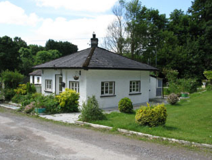 gate lodge1180 yd
Explorer Tom That gate lodge in Cloghroe has eaves so overhangy they’re basically flirting with the road. It’s a modest little guard that thinks it’s a castle, all timber windows and serious attitude. Stand there for a sec and let it think you’re important.
Ballyanly Inniscarra Slí na SláinteWalking route · 1.7 miExplorer Tom Ballyanly Inniscarra Slí na Sláinte in County Cork would be the uncle at a wedding who dances too much on the table. It’s got that sláinte vibe where everyone’s slightly drunk on the scenery and pretending they know what they’re doing. Bring a flask and pretend you own the place.
Hugh MaguireMemorial · 2.5 miExplorer Tom Hugh Maguire in County Cork is currently feuding with the rain because it keeps washing his plaque away every single time he tries to look dignified for the tourists visiting town today. The weather just doesn’t respect his legacy, which makes him very cross about the whole situation constantly. Find the wonkiest bit and send it to your group chat.
Blarney lake bird nest islandIslet · 2.6 miExplorer Tom Blarney lake bird nest island looks like it’s being managed by a very confident, slightly drunk dog that thinks it owns the place. He barks at the seagulls and pretends he knows what he’s doing with all those nests stacked up high. Leave nothing but footprints and a bad pun.
 Ballincollig CastleCastle · 3.7 mi
Explorer Tom Ballincollig Castle sits high enough to watch the Maglin Valley and low enough for me to imagine I could defend it. The Barrett family bought land here around 1468 and developed the stronghold. The keep, much of the curtain wall and two towers survive above a limestone summit; below is a natural cavern. I would announce a secret tunnel through it, but the source only promises a cavern, so there my adventure must stop. The Barretts had a fine view of the low ground, which mattered far more than my dramatic tales. Check current legal access before approaching, and stay off crumbling walls and any opening in the rock. Look from a safe distance at the enclosure's outline. It is a reminder that a good view once counted as practical defence.
Ballincollig Castle (in Ruins)Bawn · 3.7 miExplorer Tom The Bawn of Ballincollig Castle has a big gap in the east wall. It runs around the edge of the rocky outcrop with rounded corners. There’s a tower inside the corner that matches the bawn wall nicely.
 Grave YardGraveyard · 4.1 mi
Explorer Tom Graveyard in Kilnaglory has a church ruin in the middle that's seen better days. Headstones go back to 1760, so plenty of ancestors are chatting away under the dirt. Give them a wave for me!
 Kilcrea FriaryGraveyard · 5.5 mi
Explorer Tom Kilcrea Friary in County Cork looks like it’s been losing a long argument with the local breeze for centuries. The walls are leaning over like they’re checking their phones. Best seen with a hangover and a sausage roll.
 Kilcrea CastleWood · 5.7 mi
Explorer Tom Kilcrea Castle almost hides among the trees beside the River Bride, which is no way for a five-storey tower to seek applause. Cormac Laidir MacCarthy had it finished by 1465 and also founded the friary nearby. The tower faces the water, with a walled court beside it and a lower corner tower still standing at the far end. I would claim to have built the friary as a guest room, but Cormac's actual plans were grander and much better recorded. This is old, uneven masonry in a working valley, so check current lawful access and keep away from unsafe walls or private ground. See the friary on the same outing if its access permits. Look back from the river side before you leave. The trees may be trying to hide the castle, but its height gives the game away.
 New TipperaryVisitor information · 6.4 mi
Explorer Tom New Tipperary hosted a dance once where someone actually fell into the well and didn't apologise for two weeks. It’s now just a little info point that’s seen better centuries. Bring the dog, it'll have opinions.
More archaeology and monuments in County Cork · All of County Cork

What do you know about this place?Tap to add a comment or ask a question