
What is recorded here
Detached three-bay three-storey rubble stone corn mill, c.1800. Extended, c.1825, comprising four-bay two-storey wing to right (north). Reroofed, c.1925. Decommissioned, pre-1927. Renovated, c.1950, with some openings remodelled (including insertion of square-headed carriageways). Part reroofed, c.2000. Now in use as outbuilding. Pitched roof to original block with painted replacement corrugated-iron, c.1925, iron ridge tiles, rendered coping, and no rainwater goods on squared rubble stone eaves. Pitched roof to wing with replacement corrugated-iron, c.2000, iron ridge tiles, rendered coping, and no rainwater goods. Random rubble stone walls with lime mortar, sections of unpainted lime render over to original block, and section of unpainted replacement cement render, c.1950, to wing. Square-headed window openings with stone sills, timber lintels supporting rubble stone voussoirs, and remains of timber fittings (some openings blocked-up with random rubble stone). Square-headed carriageways inserted, c.1950, with lintels, and painted corrugated-iron sliding doors. Interior with timber floors on timber beams supported by timber posts, and remains of early or original iron mechanisms. Set back from line of road with verge to front.
A picturesque building forming an appealing feature in the streetscape. The building is of particular importance for its original intended use, and survives as a reminder of a small-scale industrial centre that historically supported the agricultural economy of the locality. The survival of early or original mechanisms to the interior is particularly important.
From the Buildings of Ireland (National Inventory of Architectural Heritage) record 22902304
This does not grant access. Most recorded buildings are privately owned; view them only from public ground unless the owner allows entry.
Places near here
Photo credits
- National Inventory of Architectural Heritage
- kevin higgins, Geograph · CC BY-SA 2.0
- Rwxrwxrwx at English Wikipedia, Wikimedia Commons · Public domain
- Stephan van Helden, Wikimedia Commons · CC BY-SA 4.0
- John M, Geograph · CC BY-SA 2.0
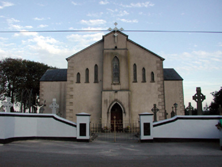 Saint Bridget's Catholic ChurchOfficially recorded historic building · 167 ydGrave YardGraveyard · 200 ydHoly well in KilrossantyHoly well · 905 ydBawn in BarnankileBawn · 1088 yd
 farm house1555 ydChurch (in ruins)Castle, unclassified · 2.5 mi
 SeefinMountain / peak · 3.4 mi
 Mahon ValleyCliff · 3.8 mi
 Mahon FallsWaterfall · 4.0 mi
 KnockaunapeebraMountain / peak · 4.3 mi
 Horse-chestnut4.6 mi
 Stradbally CoveBeach / strand · 5.2 mi
More historic places in County Waterford · All of County Waterford
What do you know about this place?