What is recorded here
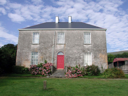
According to the Civil Survey of 1654-6 the large house of Darby O'Brien at Barnakile (WA023-011001-) was foritified by a bawn, of which there is no surviving evidence (Simington 1929, 78). Simington, R. C. (ed.) (1942) The Civil Survey AD 1654-1656, vi, the County of Waterford. Irish Manuscripts Commission. Dublin.
From the National Monuments Service (Archaeological Survey of Ireland) record WA023-011002
The monument record does not grant public access. Check the route and ask the landowner before entering private land.
- What survives
- Recorded monument
Places near here
Photo credits
- National Inventory of Architectural Heritage
- kevin higgins, Geograph · CC BY-SA 2.0
- Stephan van Helden, Wikimedia Commons · CC BY-SA 4.0
- Rwxrwxrwx at English Wikipedia, Wikimedia Commons · Public domain
- Robert French, Wikimedia Commons · Public domain
- John M, Geograph · CC BY-SA 2.0
 farm house612 yd
 Mount KennedyHouse · 652 ydGrave YardGraveyard · 1239 ydChurch (in ruins)Castle, unclassified · 2.3 miBawn in Castlequarter (decies Without Drum By., Kilrossanty Par.)Bawn · 2.6 mi
 SeefinMountain / peak · 3.8 mi
 Horse-chestnut4.0 mi
 Mahon ValleyCliff · 4.4 mi
 Mahon FallsWaterfall · 4.6 mi
 CastleStructure · 4.6 mi
 Stradbally CoveBeach / strand · 4.8 mi
 KnockaunapeebraMountain / peak · 4.9 mi
More castles and forts in County Waterford · All of County Waterford
What do you know about this place?