
What is recorded here
From the National Monuments Service (Archaeological Survey of Ireland) record MA117-053
Places near here
Photo credits
- Maker not stated on source page, www.pinterest.com
- Maker not stated on source page, en.wikipedia.org
- National Inventory of Architectural Heritage
- Maker not stated on source page, www.bbc.com
- Maker not stated on source page, storage.googleapis.com
- Maker not stated on source page, tr.pinterest.com
- Nigel Thompson, Wikimedia Commons · CC BY-SA 2.0
- Maker not stated on source page, www.mayo-ireland.ie
 Anomalous stone group in CaherrobertAnomalous stone group · 811 yd
Explorer Tom Anomalous stone group in Caherrobert is two tall stones standing next to each other like they’re waiting for a bus that…
 Church (Site of)Church · 828 yd
Explorer Tom Church in Killour is hiding in the bushes because it’s shy about having only one wall left. Its first owner probably…
 Loughmask HouseGates/railings/walls · 1270 yd
Explorer Tom Loughmask House is a gateway structure that sits proudly at the entrance to the estate grounds in Caherloughlin. It’s…
 Flat cemetery in BallinchallaFlat cemetery · 1392 yd
Explorer Tom Flat cemetery in Ballinchalla sparked such a massive argument that three families still don’t speak to each other. The…
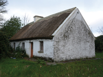 farm house1551 yd
Explorer Tom Farm house in Castletown [kilm. by. B.chal. Ph.] in Castletown [Kilm. By. B.Chal. Ph.], County Mayo would bring a wheel…
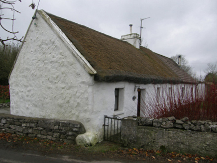 White O'MornFarm house · 1553 yd
Explorer Tom White O'Morn in Castletown is doing its best impression of a stone fortress that’s actually just very shy. It’s got…
 Castle in ruinsCastle, tower house · 1603 yd
Explorer Tom This Castle in ruins at Castletown rearranges its own furniture when nobody is looking, just to keep the ghosts…
 Fairy fort / stone ringfort in BallinchallaFairy fort / stone ringfort · 1715 yd
Explorer Tom Fairy fort / stone ringfort in Ballinchalla would make Saint Patrick pause and wonder why anyone bothered building a…
 CastleCastle, unclassified · 1.4 mi
Explorer Tom This castle in Muckrussaun is definitely hiding a biscuit tin from 1574 that Richard MacMoyler forgot about while…
 Neale CemeteryCemetery · 1.6 mi
Explorer Tom Neale Cemetery in Mayo was supposedly invented by a local lad who just needed somewhere to park his tractor…
 InishoicenlackboyIslet · 2.3 mi
Explorer Tom Inishoicenlackboy is run by a dog who answers to no one and bites everyone. The name is so long the postman gives up…
 Carrigeendawn IslandsIslet · 2.4 mi
Explorer Tom Carrigeendawn Islands are in a bitter dispute over parking rights that has been going on since the dawn of time, which…
More archaeology and monuments in County Mayo · All of County Mayo

What do you know about this place?Tap to add a comment or ask a question