
What is recorded here
From the National Monuments Service (Archaeological Survey of Ireland) record MA120-075
Places near here
Photo credits
- National Inventory of Architectural Heritage
- Maker not stated on source page, en.wikipedia.org
- Mike Searle, Wikimedia Commons · CC BY-SA 2.0
- Maker not stated on source page, tr.pinterest.com
- Maker not stated on source page, za.pinterest.com
- Maker not stated on source page, www.tripadvisor.com.au
- Nigel Thompson, Wikimedia Commons · CC BY-SA 2.0
- Maker not stated on source page, www.pinterest.com
 Loughmask HouseGates/railings/walls · 766 yd
Explorer Tom Loughmask House is a gateway structure that sits proudly at the entrance to the estate grounds in Caherloughlin. It’s…
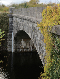 Carrownagower BridgeBridge · 1538 yd
Explorer Tom Carrownagower Bridge gave up sugar for Lent, not its stone arches. The County built it to look elegant, which is…
 Church (Site of)Church · 1631 yd
Explorer Tom Church in Killour is hiding in the bushes because it’s shy about having only one wall left. Its first owner probably…
 Loughmask CastleCastle · 1.0 mi
Explorer Tom Loughmask Castle has a secret talent for looking incredibly dramatic in bad weather, which it uses as an excuse not to…
 Loughmask Castle in ruinsCastle, tower house · 1.0 mi
Explorer Tom Loughmask Castle smells like old money and damp stone, according to Tom’s sensitive nose. It had gargoyles in 1480…
 CastleCastle, unclassified · 1.1 mi
Explorer Tom This castle in Muckrussaun is definitely hiding a biscuit tin from 1574 that Richard MacMoyler forgot about while…
 sluice/sluice gate1.6 mi
Explorer Tom Sluice in Caherloughlin is known as The Regulator because it controls water flow, but locals claim a specific farmer…
 Fairy fort / stone ringfort in Cahernichole East,cahernichole WestFairy fort / stone ringfort · 1.7 mi
Explorer Tom Fairy fort / stone ringfort in Cahernichole East, Cahernichole West holds a world record for being unnamed on any map.…
 Church in InishmaineChurch · 1.7 mi
Explorer Tom Church in Inishmaine started because two lads made a bet in the pub about who could build it first. They probably lost…
 Neale Church (Ballinchalla-Kilmolara)Church/chapel · 1.7 mi
Explorer Tom Neale Church would cope fine on a reality show by just standing there and letting everyone else be dramatic. It’s a…
 Neale CemeteryCemetery · 1.7 mi
Explorer Tom Neale Cemetery in Mayo was supposedly invented by a local lad who just needed somewhere to park his tractor…
 InishoicenlackboyIslet · 2.4 mi
Explorer Tom Inishoicenlackboy is run by a dog who answers to no one and bites everyone. The name is so long the postman gives up…
More archaeology and monuments in County Mayo · All of County Mayo

What do you know about this place?Tap to add a comment or ask a question