
What is recorded here
From the National Monuments Service (Archaeological Survey of Ireland) record CO016-122
Places near here
Photo credits
- Maker not stated on source page, it.pinterest.com
- National Inventory of Architectural Heritage
- Maker not stated on source page, ca.pinterest.com
- Maker not stated on source page, www.youtube.com
- Maker not stated on source page, en.wikipedia.org
- Maker not stated on source page, www.irishmirror.ie
- Kmcnamee, Wikimedia Commons · CC BY-SA 4.0
- Mike Searle, Wikimedia Commons · CC BY-SA 2.0
 Fairy fort / earthen ringfort in CurrymountFairy fort / earthen ringfort · 604 yd
Explorer Tom Fairy fort / earthen ringfort in Currymount has two big breaks in its bank where farm trackways used to cross. The…
 Mount CorbittCountry house · 930 yd
Explorer Tom Mount Corbitt in Mountcorbitt is doing its best to look grand while getting a facelift. Built around 1780, it’s…
 Curraghmount HouseCountry house · 1012 yd
Explorer Tom Curraghmount House in Currymount would tell a teenager that the 1800s were basically just people arguing about who had…
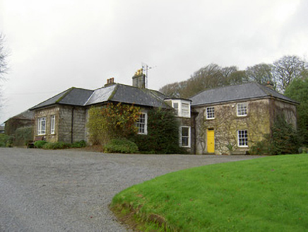 Egmont CottageHouse · 1297 yd
Explorer Tom Egmont Cottage in Egmont was built for estate retainers back in 1840. It’s got an L-plan and some terracotta pots that…
 Church in Tullig (orrery and Kilmore By.)Church · 1478 yd
Explorer Tom Church in Tullig is supposedly near a well called Toberheighue, but the exact location is unknown, so it’s playing hard…
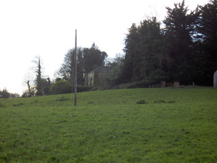 Tullig HouseCountry house · 1522 yd
Explorer Tom Tullig House in Tullig is throwing a silent party I didn't get invited to. The lodge gate is probably judging my outfit…
 Enclosure in BallygraceEnclosure · 1656 yd
Explorer Tom Enclosure in Ballygrace is hiding from a bishop who refused to visit because he thought the parking was too difficult…
 Saint Brigid's CemeteryGraveyard · 1711 yd
Explorer Tom Saint Brigid's Cemetery is hosting an exclusive after-party that only the really old and the really wet can attend. I…
 CastleCastle, unclassified · 1.1 mi
Explorer Tom Castle in Bregoge would win the lotto and use all the money to fix its roof, because being a ruined castle is no fun…
 Bregoge HouseHouse · 1.1 mi
Explorer Tom Bregoge House was designed by a mother-in-law with a ruler and a grudge, ensuring every inch is perfectly symmetrical…
 Churchtown GAA pitchGAA ground · 1.6 mi
 Lisgriffin CastleCastle · 1.7 mi
Explorer Tom Lisgriffin Castle in County Cork is just standing there with a look that says 'I have seen things.' It might be waiting…
More archaeology and monuments in County Cork · All of County Cork

What do you know about this place?Tap to add a comment or ask a question