What is recorded here
From the National Monuments Service (Archaeological Survey of Ireland) record GA017-116
Places near here
Picture notes
- Computer-made picture. It does not show this monument.
- National Inventory of Architectural Heritage
- Computer-made picture. It does not show this playground.
- JohnArmagh, Wikimedia Commons · CC BY-SA 3.0
- Dougbermingham at en.wikipedia, Wikimedia Commons · CC0
- Computer-made picture. It does not show this mountain top.
 Man-made underground passage in KilluneyMan-made underground passage · 1 ydComputer-made picture
Explorer Tom A man-made underground passage in Killuney that locals swear is a tunnel to nowhere. It’s got more mystery than my ex. Ideal for a moody photo you'll pretend wasn't posed while you wait for the ghost to say hi.
 Fulacht FiadhaighFulacht fia · 487 ydComputer-made picture
Explorer Tom Another Fulacht Fiadhaigh in Killuney that Dr. Costello 'excavated' in 1932. He probably just kicked the mud around and called it science. Whisper a secret at it, it's kept worse than my gym membership.
 TombBurial · 638 ydComputer-made picture
Explorer Tom Tomb in Killuney is just a table made of concrete with a cross on top, no frills included. They say it's from the plague, but I think it's just a bench that got stuck. It's free, it's odd, what more do you want from a hill?
 DolmenAnomalous stone group · 862 ydComputer-made picture
Explorer Tom Dolmen is marked on old maps but levelled during land reclamation. It’s basically a ghost with a past, hiding under some grass because it’s shy. Count the crows, then count again.
 IndicatedEcclesiastical enclosure · 937 ydComputer-made picture
Explorer Tom Ecclesiastical enclosure in Addergoole More has a New Year’s resolution to stop looking like a random hedge. It sits by a pond, judging your life choices. Pretend you're a lost aristocrat, nobody will check.
 Cross-slab in Addergoole MoreCross-slab · 958 ydComputer-made picture
Explorer Tom An Choill Bheag Íochtair has a mossy pillar with a pocked cross on both sides. It’s basically a stone sandwich that forgot its filling. Great spot to propose. Or at least to propose lunch.
 Enclosure in Addergoole MoreEnclosure · 959 ydComputer-made picture
Explorer Tom Enclosure in Addergoole More is a circle that can’t decide if it wants to be a field boundary. The wind picks on it because it looks indecisive. Pack a picnic and an excuse.
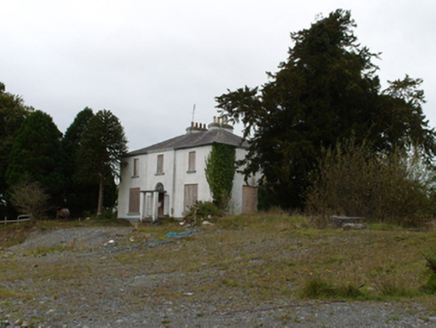 Eiscir ViewHouse · 1587 yd
 Children's playground1645 ydComputer-made picture
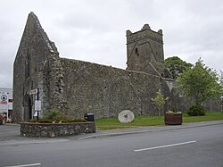 Abbey (in ruins)Religious house, Augustinian friars · 1677 yd
Explorer Tom Abbey in Abbeyland South has a hidden message in its stones that says 'we forgot about this place.' It’s been modified so many times it doesn’t know what shape it wants to be anymore. Go back in winter, it's a different animal.
 Dunmore CastleCastle, hall-house · 1.7 mi
Explorer Tom Dunmore Castle in Castlefarm is a massive keep that has been rebuilt more times than I've changed my mind about lunch. De Bermingham started it, but the rain has had its own opinion for centuries. Have a nosey, politely, and don't touch anything.
 KnockmannananMountain / peak · 1.9 miComputer-made picture
More archaeology and monuments in County Galway · All of County Galway

What do you know about this place?Tap to add a comment or ask a question