What is recorded here
From the National Monuments Service (Archaeological Survey of Ireland) record CO045-039
Places near here
Photo credits
- Maker not stated on source page, www.ncronline.org
- Maker not stated on source page, www.dreamstime.com
- National Inventory of Architectural Heritage
- Maker not stated on source page, ca.pinterest.com
- Maker not stated on source page, commons.wikimedia.org
- Revd. Matthew Morgan, Wikimedia Commons · Public domain
- Maker not stated on source page, www.artec3d.com
- Denis Minihane / Echo Live, www.echolive.ie
 Church (in Ruins)Church · 1001 yd
Explorer Tom Church in Ballinterry is roofless and probably listening to a fiddler’s ghost who never finished his tune. It looks…
 Gortroe CemeteryCemetery · 1001 yd
Explorer Tom Gortroe Cemetery is built on a legend that a giant once sneezed so hard he created the whole place just to clear his…
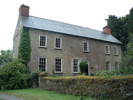 Ballinterry HouseCountry house · 1157 yd
Explorer Tom Ballinterry House has a facade that screams 'I cost more than your house' without saying a word. It’s got those…
 Ballinterry BridgeBridge · 1309 yd
Explorer Tom Ballinterry Bridge has been holding back the Knoppoge River since about 1830. Five arches, including one just for…
 Ward's BridgeBridge · 1586 yd
Explorer Tom Ward's Bridge over River Flesk has three arches that look like they’re holding their breath. Built c.1840, the…
 Sheelaboynashkeanes CastleCastle, unclassified · 1731 yd
Explorer Tom Sheelaboynashkeanes Castle is built into a farmyard and smells like old history. It was supposedly occupied by 'Yellow…
 Ecclesiastical enclosure in Deerpark (barrymore By.)Ecclesiastical enclosure · 1.1 mi
Explorer Tom Ecclesiastical enclosure in Deerpark was nearly sold off as a horse on a whim during a particularly bad harvest year…
 Rathcormac massacreMassacre · 1.2 mi
Explorer Tom The Rathcormac Massacre of 1834 saw farmers hiding behind haystacks like it was a game of hide-and-seek with soldiers.…
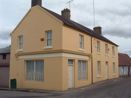 post office1.3 mi
Explorer Tom Post office in Ballynakilla has changed its name so many times it’s starting to get confused about whether it delivers…
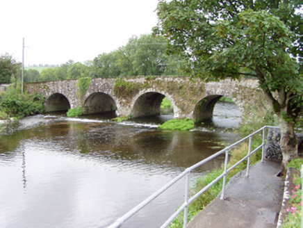 Bride BridgeBridge · 1.3 mi
Explorer Tom Bride Bridge over the River Bride is a solid hump-back structure built around 1790 with finely carved V-cutwaters. The…
 Ogham stone (present location) in Baneena SouthOgham stone (present location) · 1.4 mi
Explorer Tom Ogham stone in Baneena South was moved to a school yard because it got tired of standing in Rathcobane. It has a name…
 Rathcormac, Bride RoversGAA ground · 1.7 mi
More archaeology and monuments in County Cork · All of County Cork

What do you know about this place?Tap to add a comment or ask a question