
What is recorded here
Four-arched road bridge over Knoppoge River, built c. 1830, having fifth arch to west end functioning as flood arch. Elliptical arches, middle arch being higher, with well-defined vertical tooling to arch voussoirs. Coursed rubble stone walls and parapets, with render copings, having V-cutwaters to upstream elevation.
This sturdy bridge is a solidly constructed example of a nineteenth-century road bridge with cutwaters. The upstream cutwaters and fifth flood relief arch are an example engineering and design pre-empting structural problems. The features are designed to lesson the impact flood waters would have on the bridge, thus protecting its structural integrity. The bridge is an important element in the landscape and helps to contextualise the surrounding architectural heritage. It is one of two bridges with this name crossing the same river.
From the Buildings of Ireland (National Inventory of Architectural Heritage) record 20904406
This does not grant access. Most recorded buildings are privately owned; view them only from public ground unless the owner allows entry.
Places near here
Photo credits
- National Inventory of Architectural Heritage
- Revd. Matthew Morgan, Wikimedia Commons · Public domain
- Hywel Williams, Wikimedia Commons · CC BY-SA 2.0
- Mike Searle, Wikimedia Commons · CC BY-SA 2.0
Tower (in Ruins)Bawn · 189 yd Ballinterry HouseCountry house · 215 ydBallinterry BridgeBridge · 844 ydRathcormac massacreMassacre · 1.3 miSt Bartholomews WellHoly well · 1.7 miBarrymore Castle or Castle LyonsHouse, fortified house · 1.8 miDevonshire's HillMountain / peak · 3.0 miCorrin CrossMonument · 3.4 miCorrin WoodsWood · 3.5 miMonananig WoodsWood · 3.6 miCappagh XViewpoint · 4.7 miGraveyard in FermoyGraveyard · 4.9 mi
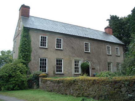 Ballinterry HouseCountry house · 215 yd
 Ballinterry BridgeBridge · 844 yd
 Rathcormac massacreMassacre · 1.3 mi
.jpg/250px-St._Bartholomews_Holy_Well_(geograph_3090257).jpg "Photo: Hywel Williams, Wikimedia Commons · CC BY-SA 2.0") St Bartholomews WellHoly well · 1.7 mi
St Bartholomews WellHoly well · 1.7 mi Barrymore Castle or Castle LyonsHouse, fortified house · 1.8 miDevonshire's HillMountain / peak · 3.0 mi
 Corrin CrossMonument · 3.4 miCorrin WoodsWood · 3.5 miMonananig WoodsWood · 3.6 miCappagh XViewpoint · 4.7 miGraveyard in FermoyGraveyard · 4.9 mi
More historic places in County Cork · All of County Cork
What do you know about this place?