What is recorded here
Adjacent to Ballinterry House (5986); 1842 OS 6-inch map shows four towers standing at corners of large, roughly square enclosure (distance between towers c. 50m), with house in centre; only ivy-clad tower to NW of house now stands. This is circular in plan (int. diam. 3.5m); door opes to N and SE have recent surrounds, latter may be in original position; six lintelled gun loops, evenly spaced, set around wall. Featureless 1st floor largely rebuilt. Walls running out from this tower, on line of bawn enclosure, not keyed in and appear to be later than tower. Tower at SW corner reduced to low overgrown mounds of rubble; no surface indication of other two towers. Surviving tower early 17th-century in appearance, probably surrounding fortified house replaced by present house in late 17th century. Not listed by Healy (1988); nothing of its earlier history appears to be known.
Adjacent to Ballinterry House (5986); 1842 OS 6-inch map shows four towers standing at corners of large, roughly square enclosure (distance between towers c. 50m), with house in centre; only ivy-clad tower to NW of house now stands. This is circular in plan (int. diam. 3.5m); door opes to N and SE have recent surrounds, latter may be in original position; six lintelled gun loops, evenly spaced, set around wall.…
From the National Monuments Service (Archaeological Survey of Ireland) record CO044-038004
The monument record does not grant public access. Check the route and ask the landowner before entering private land.
- What survives
- Recorded monument
Places near here
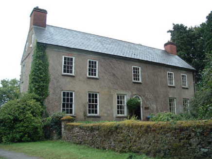 Ballinterry HouseCountry house · 35 yd
 Ballinterry BridgeBridge · 189 yd
 Ballinterry BridgeBridge · 675 yd
 Rathcormac massacreMassacre · 1.2 mi
.jpg/250px-St._Bartholomews_Holy_Well_(geograph_3090257).jpg "Photo: Hywel Williams, Wikimedia Commons · CC BY-SA 2.0") St Bartholomews WellHoly well · 1.6 mi
St Bartholomews WellHoly well · 1.6 mi Barrymore Castle or Castle LyonsHouse, fortified house · 1.9 miDevonshire's HillMountain / peak · 2.9 mi
 Corrin CrossMonument · 3.5 miMonananig WoodsWood · 3.5 miCorrin WoodsWood · 3.6 miCastle (in Ruins)Castle, unclassified · 3.7 miCappagh XViewpoint · 4.7 mi
Pictures: National Inventory of Architectural Heritage; Revd. Matthew Morgan, Wikimedia Commons · Public domain; Hywel Williams, Wikimedia Commons · CC BY-SA 2.0; Mike Searle, Wikimedia Commons · CC BY-SA 2.0
More castles and forts in County Cork · All of County Cork
What do you know about this place?