
What is recorded here
From the National Monuments Service (Archaeological Survey of Ireland) record MA015-040
Places near here
Photo credits
- Maker not stated on source page, www.gettyimages.com
- Maker not stated on source page, commons.wikimedia.org
- National Inventory of Architectural Heritage
- Maker not stated on source page, www.alamy.com
- Maker not stated on source page, en.wikipedia.org
- Killala GAA Club, via Connaught Telegraph; individual photographer not named, www.con-telegraph.ie
- Maker not stated on source page, www.pinterest.ru
 Wedge tomb in Townplots WestWedge tomb · 601 yd
Explorer Tom Wedge tomb in Townplots West has a curse that only affects people who don't wave when they pass. If you ignore it, your…
 Church in KilgobbanChurch · 1101 yd
Explorer Tom Church in Kilgobban would describe the 1800s to a teenager as 'a time when people walked everywhere and complained…
 CastlereaghWalled garden · 1167 yd
Explorer Tom Castlereagh Walled Garden is a lonely brick wall that lost its big house friend in 1937 and has been sulking ever…
 Graveyard in KillybroneGraveyard · 1360 yd
Explorer Tom Graveyard in Killybrone started because two lads bet in the pub they could find a church that wasn't there. O'Donovan…
 Church in KillybroneChurch · 1360 yd
Explorer Tom Church in Killybrone has drama with the nearest tree. The church was demolished long ago, but the tree still stands…
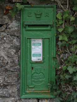 post box1561 yd
Explorer Tom Post box in Castlereagh would tell its younger self to stop worrying. It’s just a tin can with royal initials on it.…
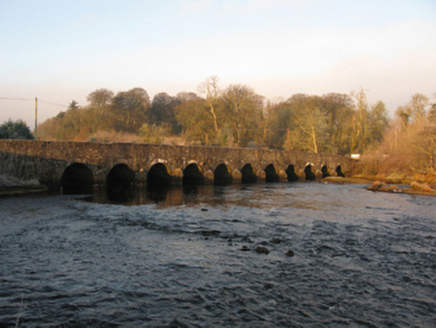 Palmerstown BridgeBridge · 1634 yd
Explorer Tom Palmerstown Bridge is plotting its escape by simply letting the sparrow-pecked limestone crumble away slowly. It’s been…
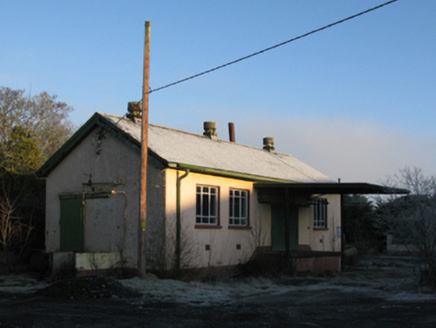 creamery1670 yd
Explorer Tom Creamery in Castlereagh is where the Palmerstown Farmers' Cooperative decided to get serious about dairy, which sounds…
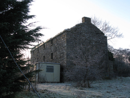 mill (water)1731 yd
Explorer Tom The mill at Castlereagh was nearly sold for a horse, but the farmer changed his mind last minute. It’s just a shell…
 Gerry Maheady Memorial Park, Killala GAAGAA ground · 1.2 mi
 Court tomb in Rathbaun (tirawley By., Templemore Par.)Court tomb · 1.2 mi
Explorer Tom Court tomb in Rathbaun would complain about the council’s lack of decorum. It’s been sitting there quietly while modern…
 Site of Carrickanass CastleCastle, unclassified · 2.3 mi
Explorer Tom Carrickanass Castle would survive a zombie attack by just letting them trip over its own very sturdy, nine-foot-high…
More archaeology and monuments in County Mayo · All of County Mayo

What do you know about this place?Tap to add a comment or ask a question