What is recorded here
Located on the crest of, and towards the S end of a NNW-SSE drumlin ridge. An embanked circular enclosure (ext. diam. c. 35m) is depicted on the 1834 edition of the OS 6-inch map where it is described in gothic lettering as a ‘fort’, and as a small hachured feature on the 1907 edition. There is a small overgrown enclosure defined by an earthen bank (Wth 2m; H 1.25m) which may be a quarry but there is no evidence of a larger enclosure.
Located on the crest of, and towards the S end of a NNW-SSE drumlin ridge. An embanked circular enclosure (ext. diam. c. 35m) is depicted on the 1834 edition of the OS 6-inch map where it is described in gothic lettering as a ‘fort’, and as a small hachured feature on the 1907 edition. There is a small overgrown enclosure defined by an earthen bank (Wth 2m; H 1.25m) which may be a quarry but there is no evidence…
From the National Monuments Service (Archaeological Survey of Ireland) record MO028-120
The monument record does not grant public access. Check the route and ask the landowner before entering private land.
- What survives
- Recorded monument
Places near here
 Mannan Castle (in ruins)Castle, Anglo-Norman masonry castle · 437 yd
 Saint Michael's Community CentreChurch/chapel · 455 yd
 Donaghmoyne Post OfficeHouse · 569 ydTobernagalliaghSpring · 1.6 mi
 Horse-chestnut2.6 mi
 European Beech3.4 miKnockreaghMountain / peak · 3.7 mi
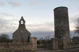 Round Tower4.7 miFincarn HillMountain / peak · 4.7 miIndicatedCastle, motte and bailey · 4.7 miGully IslandIslet · 5.1 mi
 Rath in DrummuckRath · 6.1 mi
Pictures: Kieran Campbell, Geograph · CC BY-SA 2.0; National Inventory of Architectural Heritage; Stephan van Helden, Wikimedia Commons · CC BY-SA 4.0; Malene Thyssen, Wikimedia Commons · CC BY-SA 3.0; Cathar11, Wikimedia Commons · CC0; Eric Jones, Geograph · Creative Commons Attribution-ShareAlike 2.0
More archaeology and monuments in County Monaghan · All of County Monaghan
What do you know about this place?