
What is recorded here
Donaghmoyne Post Office in Tullymackilmartin has stopped being a post office but kept the sign over its north bay window. A dangerous way to retire in Ireland: somebody will arrive with a parcel and explain that you’re only retired for people who don’t know you.
Detached three-bay single-storey house, dated 1857, formerly in use as post office, with outbuildings to rear. Pitched slate roof with red brick chimneystacks. Rubble stone walls with tooled quoins. Square-headed window openings having cut stone label-mouldings and sills and timber casement windows. Square-headed door opening having pointed cut-stone label-moulding and half-glazed timber double-leaf door. Timber date plaque over entrance and post office signage over north bay window. Two-storey outbuilding to rear having pitched slate roof, rubble stone walls, square-headed openings and timber battened door and shutters and single-storey outbuilding attached to south gable. Set back from roadside, having rubble stone boundary walls to north and south of site, with wrought-iron pedestrian entrance gate to south, wrought-iron pedestrian and farm gate to north.
This stone-built house is set prominently within the village of Donaghmoyne. Its symmetrical facade and decorative stone detailing are typical of demesne architecture. The remaining post office signage provides a reminder of its former use and the important social role the building played in the local community. The accompanying outbuildings add significantly to the context and are well built.
From the Buildings of Ireland (National Inventory of Architectural Heritage) record 41402812
This does not grant access. Most recorded buildings are privately owned; view them only from public ground unless the owner allows entry.
Places near here
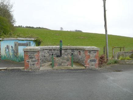 water pump21 yd
 Saint Michael's Community CentreChurch/chapel · 116 yd
 Mannan Castle (in ruins)Castle, Anglo-Norman masonry castle · 912 ydTobernagalliaghSpring · 1.7 mi
 Horse-chestnut3.0 miKnockreaghMountain / peak · 3.4 mi
 European Beech3.7 miFincarn HillMountain / peak · 4.5 mi
 Round Tower4.5 mi
 Rath in DrummuckRath · 5.8 mi
 Battle of Newry RoadBattle · 6.3 mi
 Medieval & post-med. church & graveyard in Creggan Bane GlebeMedieval & Post-med. Church & Graveyard · 6.7 mi
Pictures: National Inventory of Architectural Heritage; Kieran Campbell, Geograph · CC BY-SA 2.0; Stephan van Helden, Wikimedia Commons · CC BY-SA 4.0; Malene Thyssen, Wikimedia Commons · CC BY-SA 3.0; Cathar11, Wikimedia Commons · CC0; Eric Jones, Geograph · Creative Commons Attribution-ShareAlike 2.0; Sgt Jack Pritchard RAF, Wikimedia Commons · OGL v1.0; HENRY CLARK, Geograph · CC BY-SA 2.0
More historic places in County Monaghan · All of County Monaghan
What do you know about this place?